North Texas is looking at daily chances for severe weather almost every day this week! Let’s look ahead
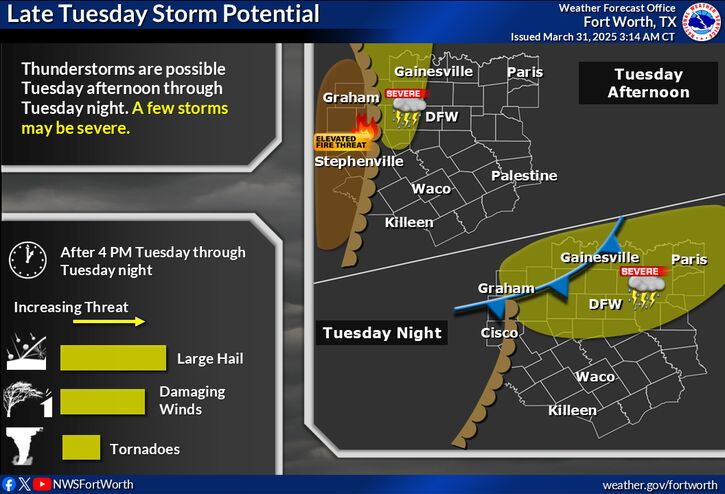
TUESDAY
Isolated supercells may develop in West Texas on Tuesday afternoon along a dry line with all weather hazards possible. Another more likely round of storms comes overnight Tuesday along with the cold front. Conditions look rather good for this storm setup.
 TIMEFRAME
4 PM into overnight hours
 WEATHER HAZARDS FOR TUESDAY
– ![]() Damaging wind gusts up to 60 MPH possible
Damaging wind gusts up to 60 MPH possible
– ![]() Isolated large hail up to 2 inches possible
Isolated large hail up to 2 inches possible
– ![]() Low tornado risk
Low tornado risk
WEDNESDAY
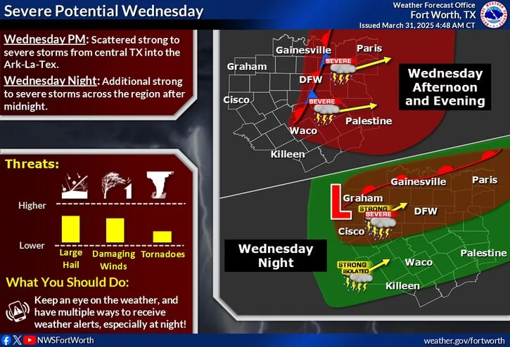
On Wednesday, we could see another 2 rounds of storms. Wednesday afternoon, we could see several scattered storms capable of producing large hail and damaging winds. After midnight, additional thunderstorms are expected to develop, capable of all weather hazards, including tornadoes. Storm coverage will be highest north of I-20.
WEATHER HAZARDS FOR WEDNESDAY
– ![]() Damaging wind gusts up to 70 MPH possible
Damaging wind gusts up to 70 MPH possible
– ![]() Large hail up to 1-2 inches possible
Large hail up to 1-2 inches possible
– ![]() Isolated tornadoes possible
Isolated tornadoes possible
THURSDAY
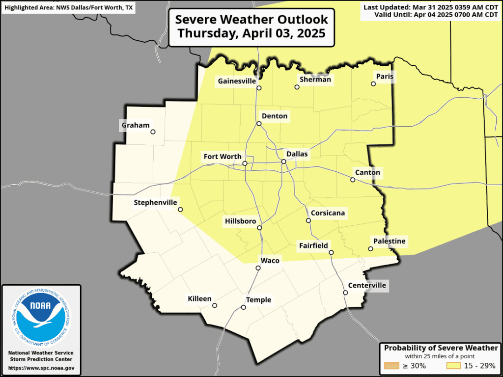
On Thursday, severe weather looks likely for DFW as well, but it is too far out to know specifics at this time
Stay weather aware!
Become a TWC Member today for FREE!
Support Texas Weather Center
Join the TWC Membership through Patreon to show your support and keep TWC high quality and FREE!
Texas Weather Center Supporters
🥉Kathryn
🥇David Bass
🥉cslewis1234
🥉Robert Fasulo
🥈Carol