 FRIDAY
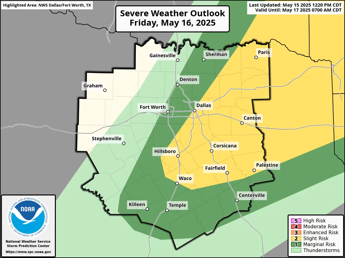
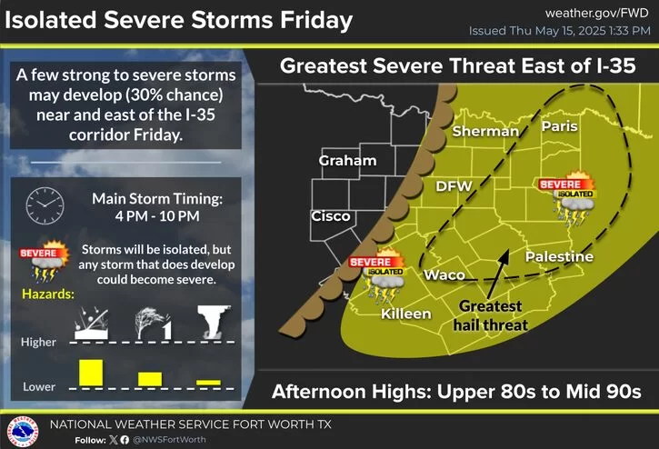
Storm chances will increase on Friday afternoon and evening. Isolated supercell storms are possible along a dry line, where they are expected to develop over DFW or just to the East. The atmosphere will be prime for storm development with plenty of energy. Storms that do develop will remain fairly isolated leaving most dry (30-40% coverage).
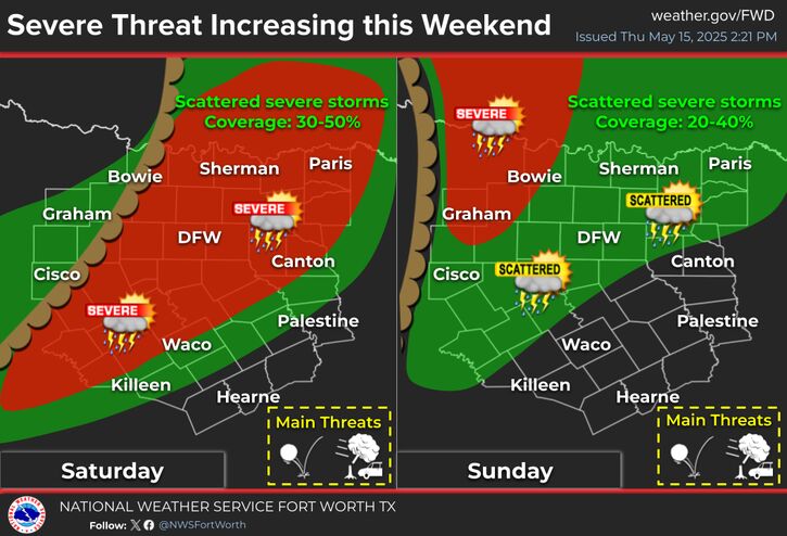
Saturday will pose a greater threat to DFW, stay tuned for a post tomorrow about Saturday’s severe weather threat.
 TIMEFRAME
4 PM – 10 PM
 WEATHER HAZARDS FOR NORTH TEXAS
– ![]() Damaging wind gusts up to 60 MPH possible
Damaging wind gusts up to 60 MPH possible
– ![]() Large hail up to 1.5 inches possible
Large hail up to 1.5 inches possible
– ![]() Low tornado risk
Low tornado risk
Looking Ahead to Saturday
Friday’s storms will be scattered, but Saturday poses a greater threat to the DFW area. Be sure to check back tomorrow for a detailed forecast update on what to expect this weekend. Extremely high levels of energy in the atmosphere are expected on Saturday leading to a favorable environment for all forms of severe weather.
Stay weather-aware!
Become a TWC Member today for FREE!
Support Texas Weather Center
Join the TWC Membership through Patreon to show your support and keep TWC high quality and FREE!
Texas Weather Center Supporters
🥉Kathryn
🥇David Bass
🥉cslewis1234
🥉Robert Fasulo
🥈Carol