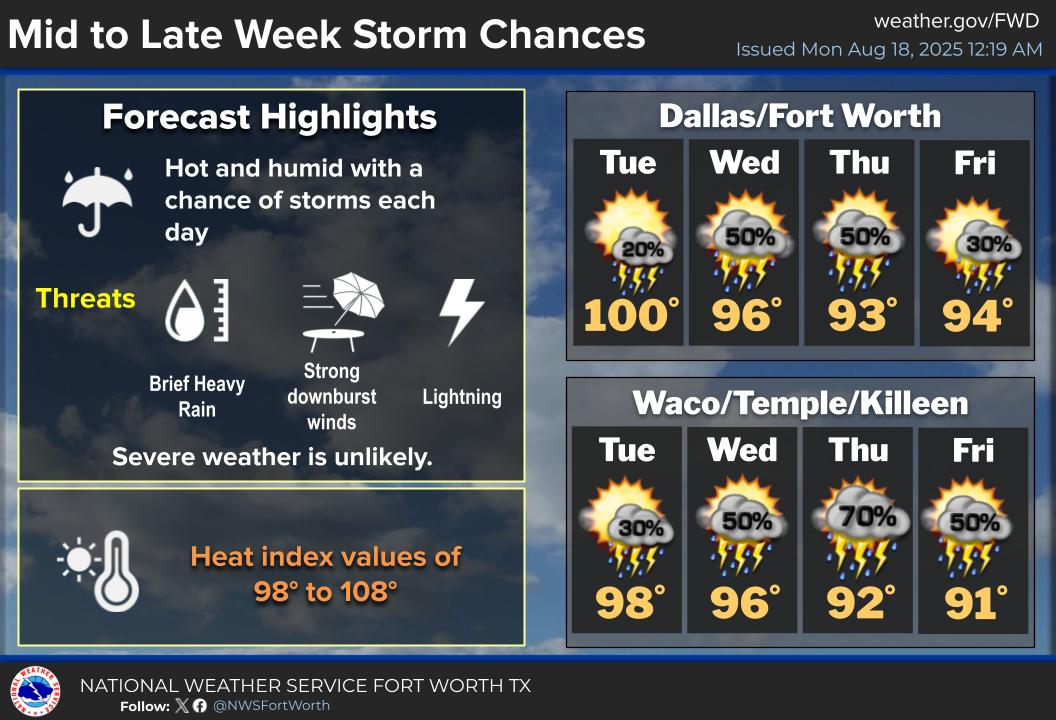
🌦️Rain Chances Return to North Texas
A weak front will be sliding through the region Tuesday and Wednesday, bringing isolated to scattered rain chances for North Texas. Not everyone will see rain, fairly low coverage. Temps will climb into the mid-90s, with heat indices pushing 105°F.
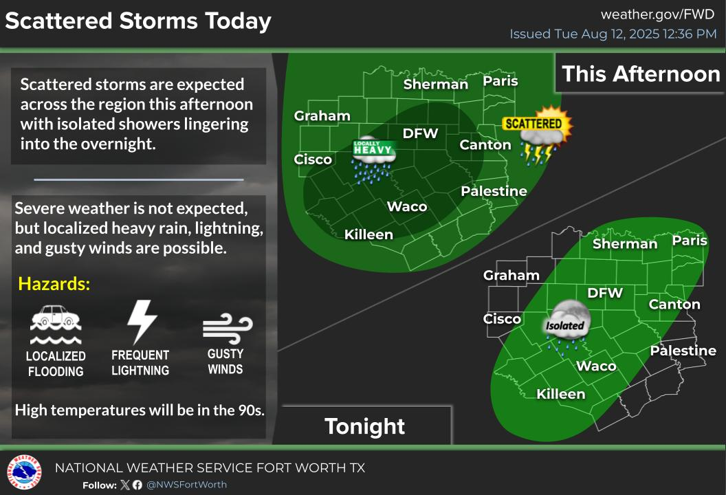
![]() STORM TIMING
STORM TIMING![]()
Tuesday / Wednesday afternoon
![]() WEATHER HAZARDS FOR NORTH TEXAS
WEATHER HAZARDS FOR NORTH TEXAS![]()
– ![]() Gusty winds in the strongest of storms
Gusty winds in the strongest of storms
– ![]() Frequent lightning
Frequent lightning
– ![]() Heavy rainfall
Heavy rainfall
☀️Summer 2025 in Review
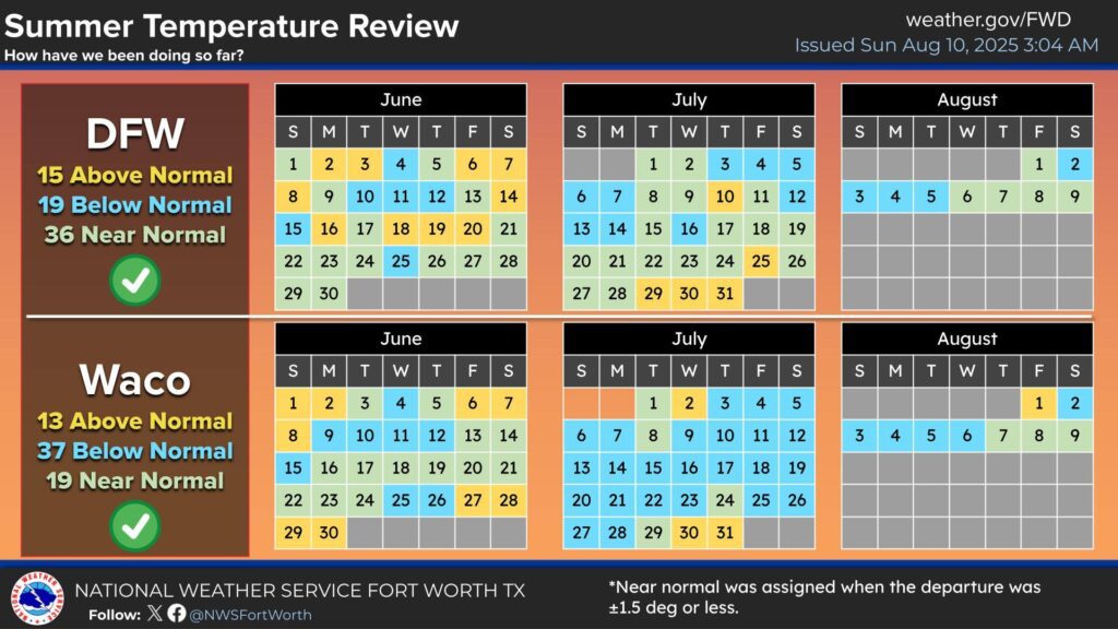
It’s been a fairly mild summer for DFW with the intense heating staying away for now. We still have more summer left, but DFW is losing daylight from now on out as Fall approaches!
📅Farmer’s Almanac Report
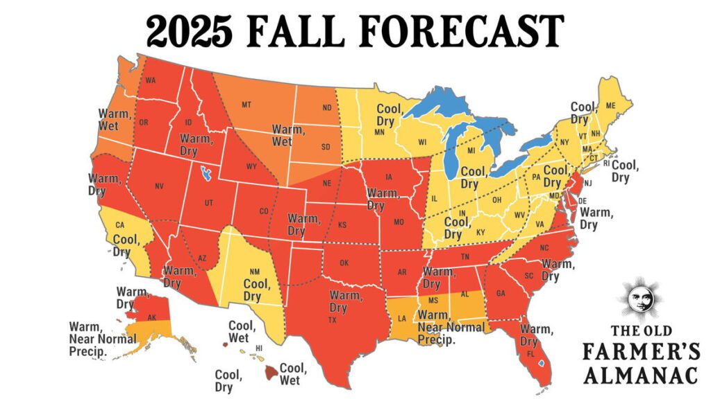
Expect a warm and dry start to Fall across much of Texas. While some areas may see near-normal precipitation and cooler temperatures, most of Texas will lean toward below-average rainfall and warmer temperatures.
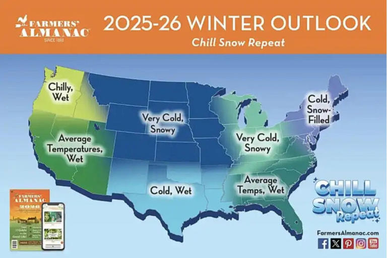
A cold and wet season is likely across Texas. That means more frequent cold fronts, increased rain chances, and possibly more icy events. Unsure on snow chances or extreme cold potential.
Keep in mind this is a very long-term forecast. Nothing can be for sure when it’s this far out. However, this can at least give us an idea of what places are most likely to see extreme weather patterns.
Update on the Tropics
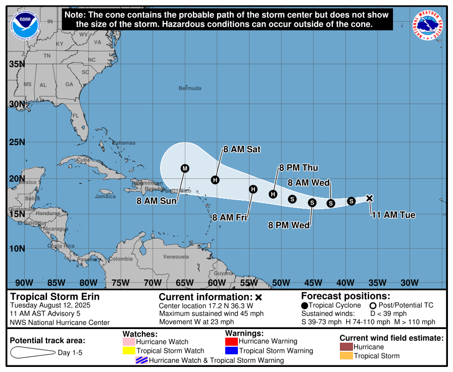
Tropical Storm Erin is steadily strengthening in the Atlantic with winds at 45 mph, moving west at 23 mph. Forecasts suggest it could become a hurricane by Thursday and possibly a major hurricane by the weekend. The National Hurricane Center is still watching for a potential US landfall in 7+ days, but right now it is too far out to know specifics. Coastal impacts like rip currents and high surf are possible. Stay tuned for updates as the track evolves.
Become a TWC Member today for FREE!
Support Texas Weather Center
Join the TWC Membership through Patreon to show your support and keep TWC high quality and FREE!
Texas Weather Center Supporters
🥉Kathryn
🥇David Bass
🥉cslewis1234
🥉Robert Fasulo
🥈Carol