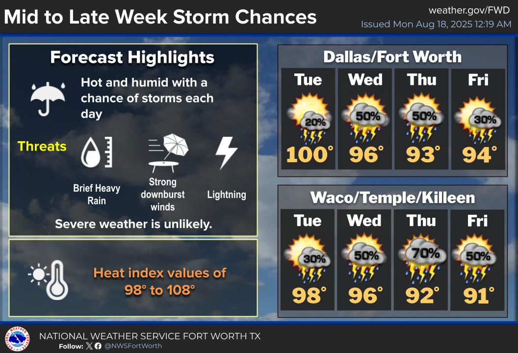
Storm chances increase mid to late week as a weak front approaches. Not everyone will see rain, but if storms do develop, expect gusty winds, downpours, and frequent lightning.
Monday
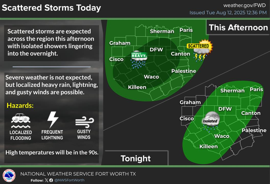
Isolated showers and storms will be possible across portions of the area this evening. Most of North texas will stay hot and humid with afternoon highs in the mid to upper 90s and heat index values between 100 to 109 degrees.
Tuesday
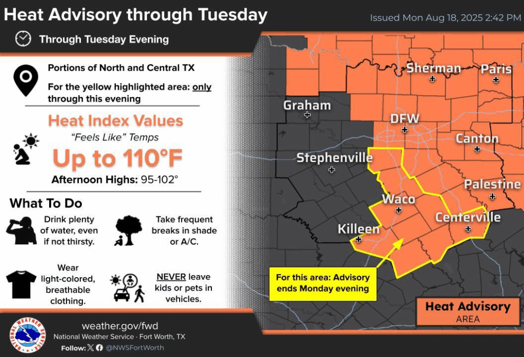
Another hot and humid day is expected on Tuesday, where parts of DFW could reach 100-102 degrees. A Heat Advisory remains in effect through Tuesday evening for much of North and Central Texas. Heat Index temps could reach 107°–110°F, with afternoon highs between 95°F and 101°F. There is a small chance of storms in North Texas, with some storms producing locally heavy rain, gusty winds, and frequent lightning.
Become a TWC Member today for FREE!
Support Texas Weather Center
Join the TWC Membership through Patreon to show your support and keep TWC high quality and FREE!
Texas Weather Center Supporters
🥉Kathryn
🥇David Bass
🥉cslewis1234
🥉Robert Fasulo
🥈Carol