SPC Discussion
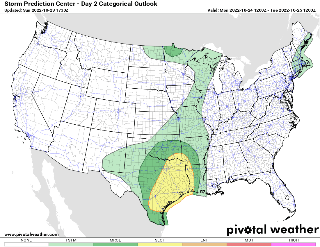
Severe thunderstorms are possible from central Texas eastward to the Arklatex, east Texas, far western Louisiana and middle/upper Texas Coast Monday evening and overnight. Damaging gusts will be the main hazard with these storms, though a tornado or two is also possible.
The front will progress eastward across KS/MO/OK during through the afternoon/evening, but become more diffuse across TX as a surface low develops across western North TX during the afternoon. The surface low should develop eastward along the Red River and into AR during the evening and overnight hours, allowing the TX portion of the cold front to surge eastward while the upper shortwave trough ejects eastward into the Plains. This will support additional thunderstorm development along the front as large-scale ascent increases within a moist and moderately unstable airmass. Linear segments will support mainly damaging gusts. However, enlarged and favorably curved low-level hodograph suggest some tornado potential will exist near the front and surface low, where low-level vorticity will be maximized.
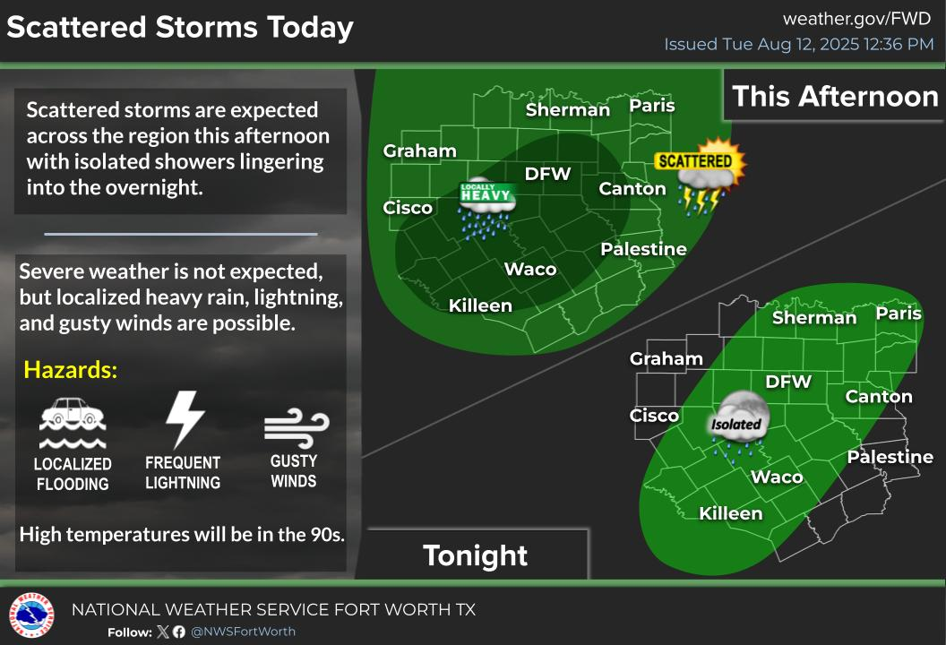
Stay weather aware throughout tomorrow. Lots of rain is expected for DFW over the course of all day Monday. Severe storms could form later in the afternoon for DFW, stay tuned to DFW Weather for more!
If storms do turn severe, follow WC on its Severe Weather Discussion page!
Become a TWC Member today for FREE!
Support Texas Weather Center
Join the TWC Membership through Patreon to show your support and keep TWC high quality and FREE!
Texas Weather Center Supporters
🥉Kathryn
🥇David Bass
🥉cslewis1234
🥉Robert Fasulo
🥈Carol