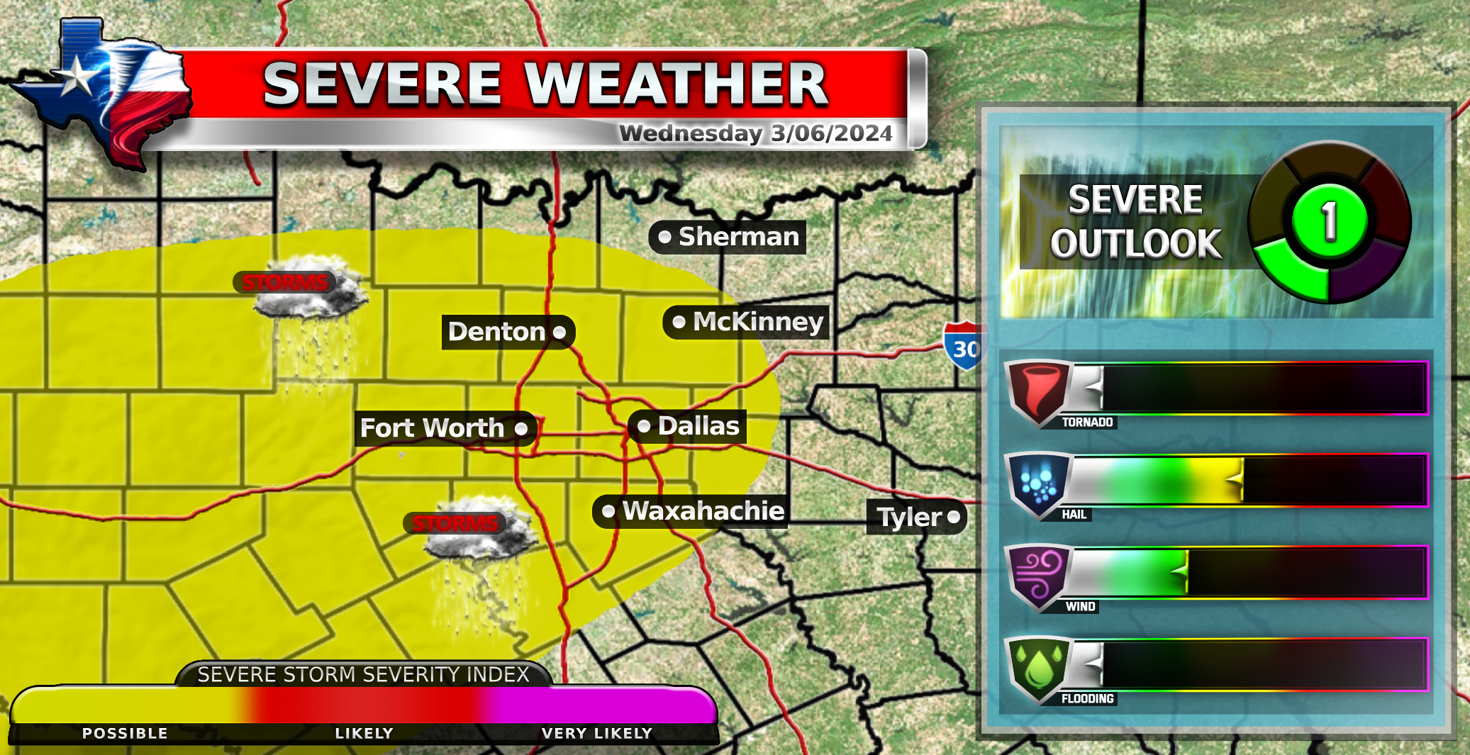
Wednesday
Severe weather is possible late Wednesday evening into night hours. A few strong to severe storms are expected throughout tonight, with the best potential near and west of I-35. DFW is under a marginal threat due to large hail being the main concern with this system. Storms will form in the west and move eastward over the evening hours around 9 PM tonight into 3 AM Thursday. Not everyone will see storms, only a portion of the metroplex could see storms and an even smaller portion will see severe weather.
1️⃣Marginal Risk
![]() Zero chance of Tornadoes
Zero chance of Tornadoes![]() Large hail up to 1.0 Inches possible
Large hail up to 1.0 Inches possible![]() Scattered damaging winds up to 65 MPH possible
Scattered damaging winds up to 65 MPH possible
Thursday
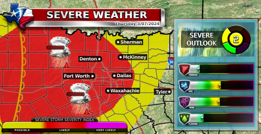
Thursday afternoon and evening also poses a threat for DFW with more severe weather possible due to a dry line. Thursday evening poses the biggest threat out of this 2-day event. DFW is under a slight risk because of a large hail and damaging wind threat with a low tornado threat. DFW is expected to see a broken squall formation late Thursday evening. Storms could form around late evening and go into the overnight hours into early Friday morning. Most of DFW should see storms but not all of them will be severe.
2️⃣Slight Risk
![]() Low chance of tornadoes
Low chance of tornadoes![]() Large hail up to 1.5 Inches possible
Large hail up to 1.5 Inches possible![]() Damaging winds up to 60 MPH
Damaging winds up to 60 MPH
Things will settle down Friday as a cold front blows in from the North into DFW after the storms leave the metroplex.
Become a TWC Member today for FREE!
Support Texas Weather Center
Join the TWC Membership through Patreon to show your support and keep TWC high quality and FREE!
Texas Weather Center Supporters
🥉Kathryn
🥇David Bass
🥉cslewis1234
🥉Robert Fasulo
🥈Carol