As seen in the previous post WC published, severe weather season is really picking up for the southern plains this weekend. Thursday through Sunday we have very significant severe weather setups including possible goliath hail, damaging winds, and several tornadoes. Friday and Saturday seem to be the main threats for DFW as of now.
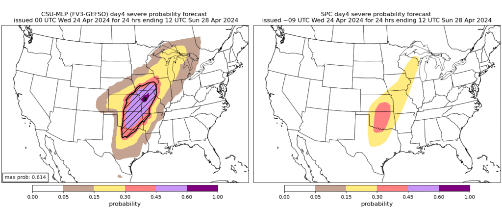
This machine-learning model is from Colorado State University. It attempts to forecast severe weather threat zones far ahead in the future, farther ahead than the Storm Prediction Center. This particular model is forecasting Saturday’s storm system. The CSU model on the left is the machine learning model and the one on the right is the SPC categorical probability. The SPC convective outlook area for Saturday won’t be released until tomorrow.
Here’s a quick overview of the timeline for storms.
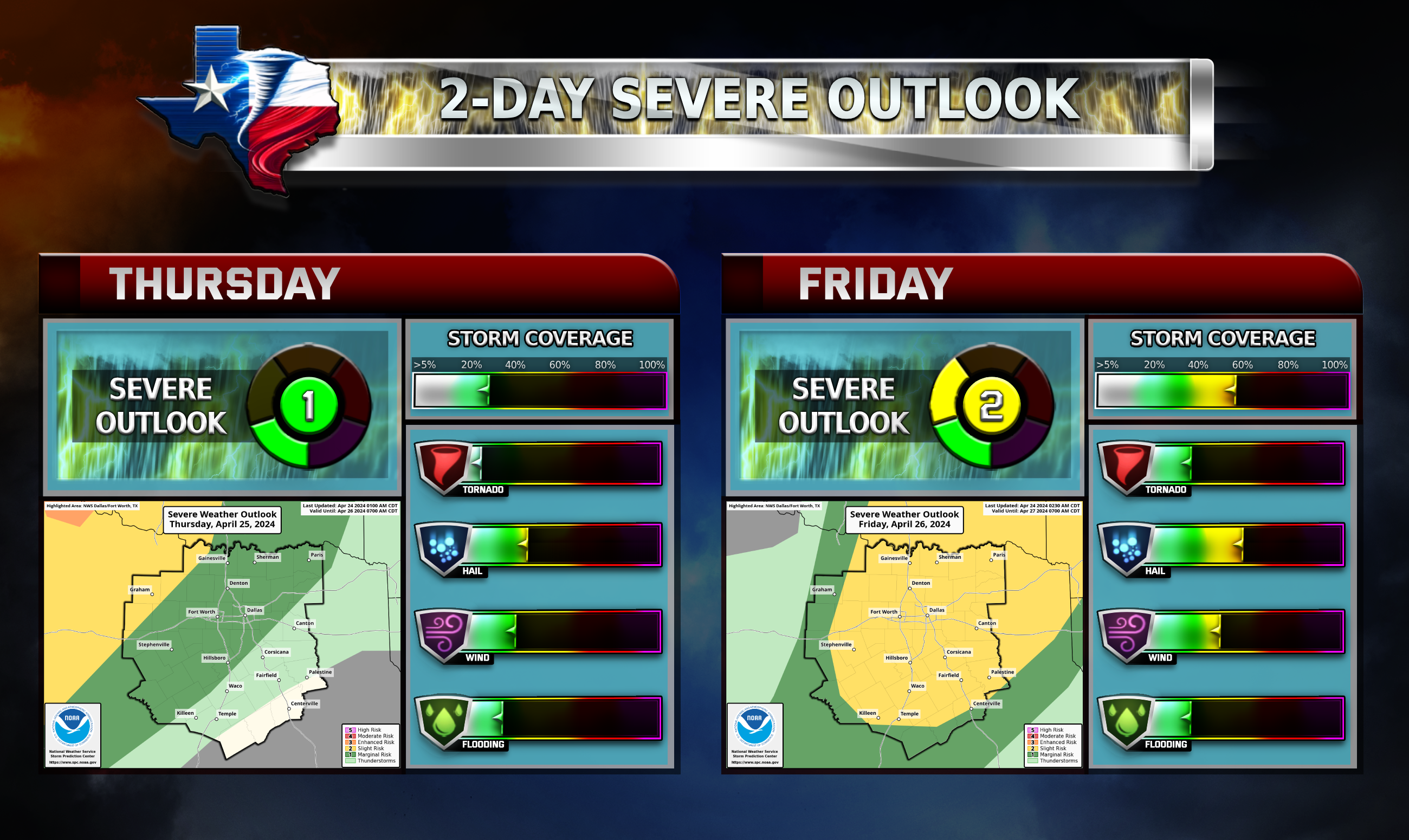
Thursday/Friday
Storms will enter the DFW area late Thursday evening and continue into Friday morning before noon. The main threat will be large hail and damaging wind gusts. Not all storms will be severe and not everyone will see storms. Friday afternoon some isolated severe storms are possible for the metroplex.
Saturday/Sunday
This is the main event WC has been talking about. The worst of the storms seem to remain just northwest of the DFW area closer to Oklahoma City. Very large hail, damaging winds, and multiple tornadoes are all hazards with this storm system. Saturday afternoon and evening is the timeframe for these storms. Timing and details are still uncertain for Saturday. Stay tuned for more details tomorrow!
Forecasts and outlook zones are LIKELY to change!
Become a TWC Member today for FREE!
Support Texas Weather Center
Join the TWC Membership through Patreon to show your support and keep TWC high quality and FREE!
Texas Weather Center Supporters
🥉Kathryn
🥇David Bass
🥉cslewis1234
🥉Robert Fasulo
🥈Carol