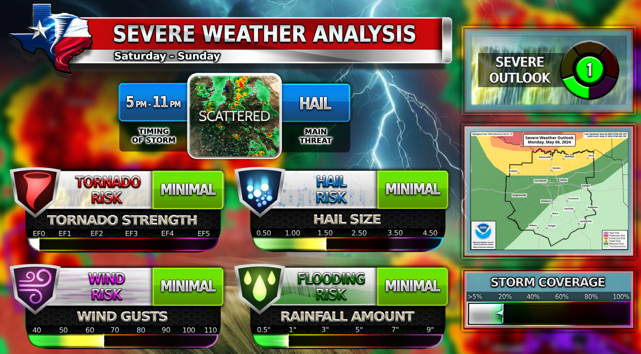
The image above is the forecast for DFW. North Texas will remain south of most of the action today and the cap will inhibit any major severe weather development. If storms do popup around DFW, they will quickly become severe. WC will monitor the area today and keep you updated on Facebook. Now for Oklahoma.
High Risk for Oklahoma Area
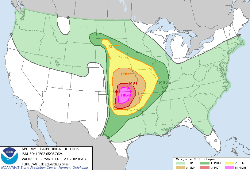
The last time the US saw this high risk was March 31, 2021. If you didn’t know, a high risk is pretty rare and not often issued by the Storm Prediction Center. It is the highest risk level. Today’s environment in that area can sustain dangerous storms with long-lived, strong tornadoes, giant hail, and damaging winds. This is a very concerning situation for anyone in the red or pink zones. A tornado outbreak is very likely for the Oklahoma area up into the southern portion of Kansas. PLEASE stay weather-aware today and prepare for many tornadoes in your area throughout the whole day.
5️⃣High Risk
![]() Multiple dangerous long-lived Tornadoes
Multiple dangerous long-lived Tornadoes![]() Giant hail up to 3-4 Inches possible
Giant hail up to 3-4 Inches possible![]() Damaging winds up to 80+ MPH possible
Damaging winds up to 80+ MPH possible
Stay weather aware all day long and pay attention to weather watches! Follow WC on Facebook to get live updates all day!
Become a TWC Member today for FREE!
Support Texas Weather Center
Join the TWC Membership through Patreon to show your support and keep TWC high quality and FREE!
Texas Weather Center Supporters
🥉Kathryn
🥇David Bass
🥉cslewis1234
🥉Robert Fasulo
🥈Carol