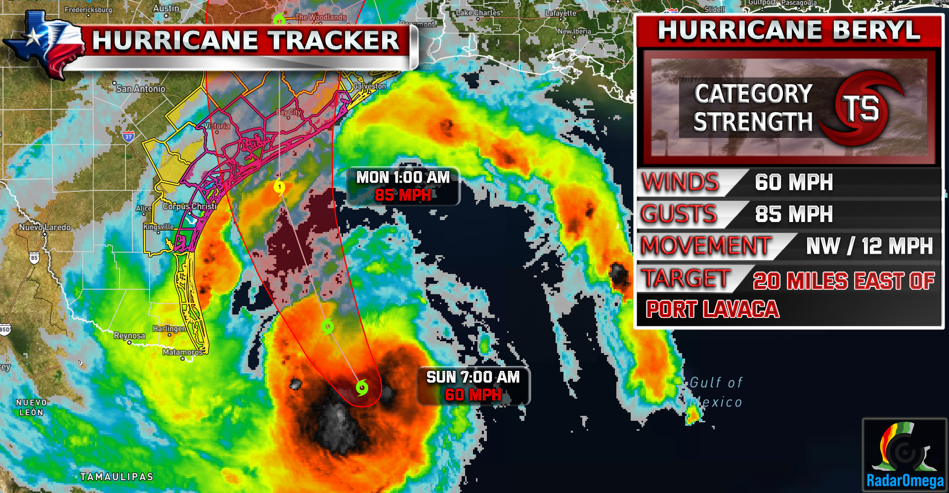
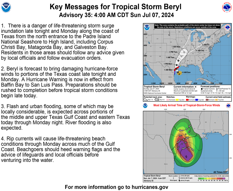
#beryl is now less than 24 hours from landfall in Texas! Beryl is currently a Tropical Storm with winds of 60 MPH but rapid intensification is expected today! Beryl is forecasted to make landfall as a CAT 1 just East of the Port Lavaca / Matagorda Bay area around 1-5 AM Monday. There is still a possibility Beryl could increase to a CAT 2 before landfall.
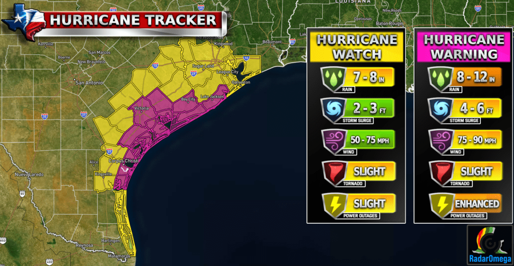
Anyone on the Texas coastline needs to be on high alert! Flooding from storm surge and heavy rain is likely across much of the Texas coastline currently under Hurricane and Tropical Storm Warnings.
Rainfall totals could be around 8-12 inches and storm surge of 3-6 feet in some areas. A tornado threat is also present for areas east of landfall where the hurricane bands move inland including the Houston area.
Stay weather aware!

Become a TWC Member today for FREE!
Support Texas Weather Center
Join the TWC Membership through Patreon to show your support and keep TWC high quality and FREE!
Texas Weather Center Supporters
🥉Kathryn
🥇David Bass
🥉cslewis1234
🥉Robert Fasulo
🥈Carol