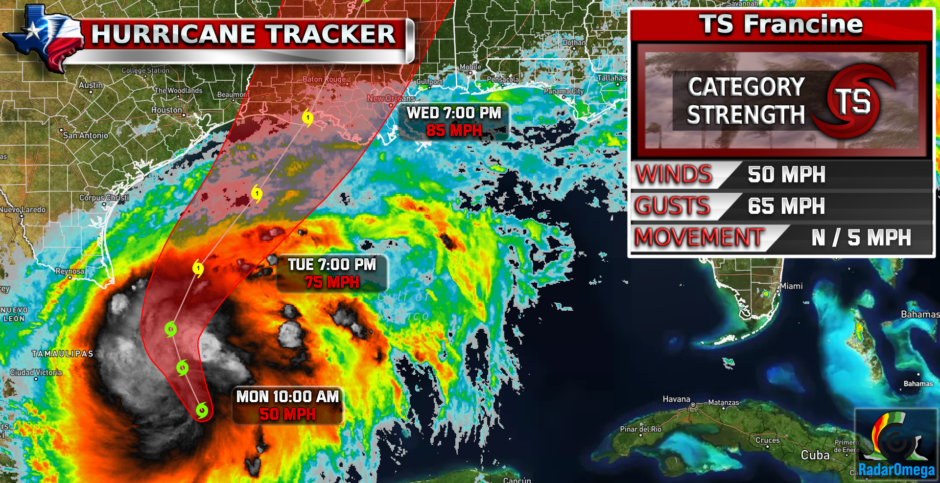
1. Francine is forecast to be a hurricane when it reaches the northwestern Gulf coast on Wednesday or Wednesday night and there is an increasing likelihood of life-threatening storm surge inundation for portions of the Upper Texas and Louisiana coastlines where a Storm Surge Watch is in effect. Residents in the watch area should follow advice given by local officials.
2. There is an increasing risk of damaging hurricane-force winds in portions of southern Louisiana beginning Wednesday, where a Hurricane Watch is now in effect.
3. Francine is expected to bring heavy rainfall and the risk of considerable flash flooding along the coast of far northeast Mexico, portions of the southernmost Texas coast, the Upper Texas Coast, southern Louisiana, and southern Mississippi into Thursday morning. A risk of flash and urban flooding exists across portions of the Mid-South from Wednesday into Friday morning.
We have our sixth named storm of the season now, Tropical Storm Francine. This storm became Tropical storm strength this morning and is expected to reach a strong CAT 1 strength and make landfall Wednesday evening. This storm is not to be taken lightly. The National Hurricane Center has already issued a hurricane/ tropical storm watches for portions of Louisiana coastline. Storm surge expectancy indicates up to 10 feet in some areas. While the rainfall or tornado threat will not be as severe as Beryl was, the storm surge and the slow speed of the storm will be a big concern. Stay tuned for more updates.

| Satellite Imagery
See the latest Satellite Imagery of the southern plains, the US, and the whole disk! See various types of imagery like infrared, water vapor, visible, and more!
Landfall
5:00 PM Wednesday
Current Intensity
TS / 50 MPH
Max Expected Intensity
CAT 1 / 85 MPH
Storm Movement
N/NW 5 MPH
Peak Storm Surge
7-10 FT
Max Rainfall Totals
8-9 Inches
| Rainfall Totals

| Peak Storm Surge

| Flash Flood Outlook

| Tornado Outlook
| TWC Info Maps

| TS Force Wind Probabilities

| Hurricane Wind Probabilities

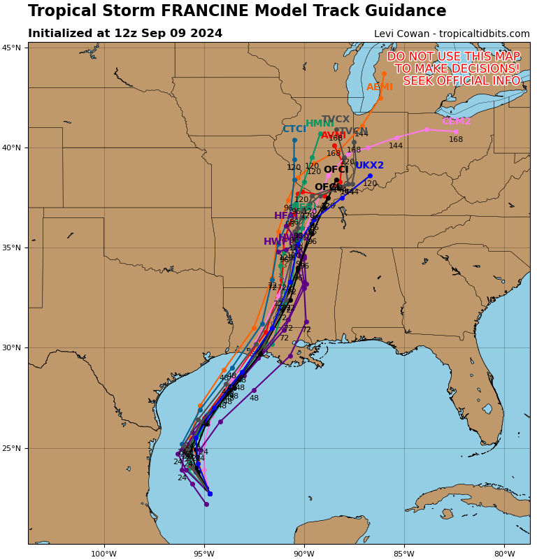
| Tracking Map

| Spaghetti Models
| Warnings / Surface Winds

| Latest IR Satellite Imagery

Become a TWC Member today for FREE!
Support Texas Weather Center
Join the TWC Membership through Patreon to show your support and keep TWC high quality and FREE!
Texas Weather Center Supporters
🥉Kathryn
🥇David Bass
🥉cslewis1234
🥉Robert Fasulo
🥈Carol