Every day for the next 5 days, North Texas has a risk of severe weather! Be sure to follow TWC closely and follow Texas Weather Center’s Facebook page to stay updated with the latest!
TUESDAY
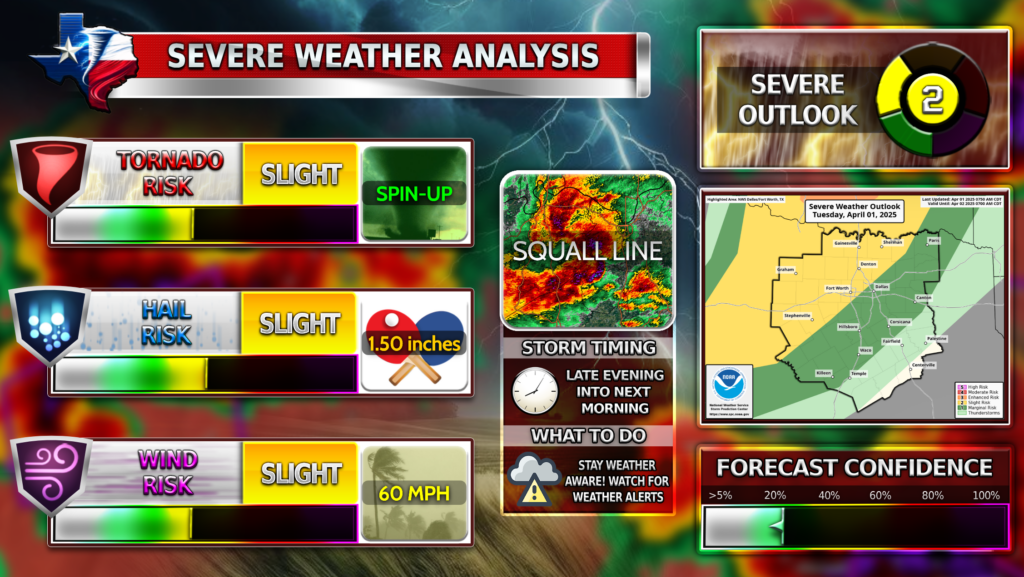
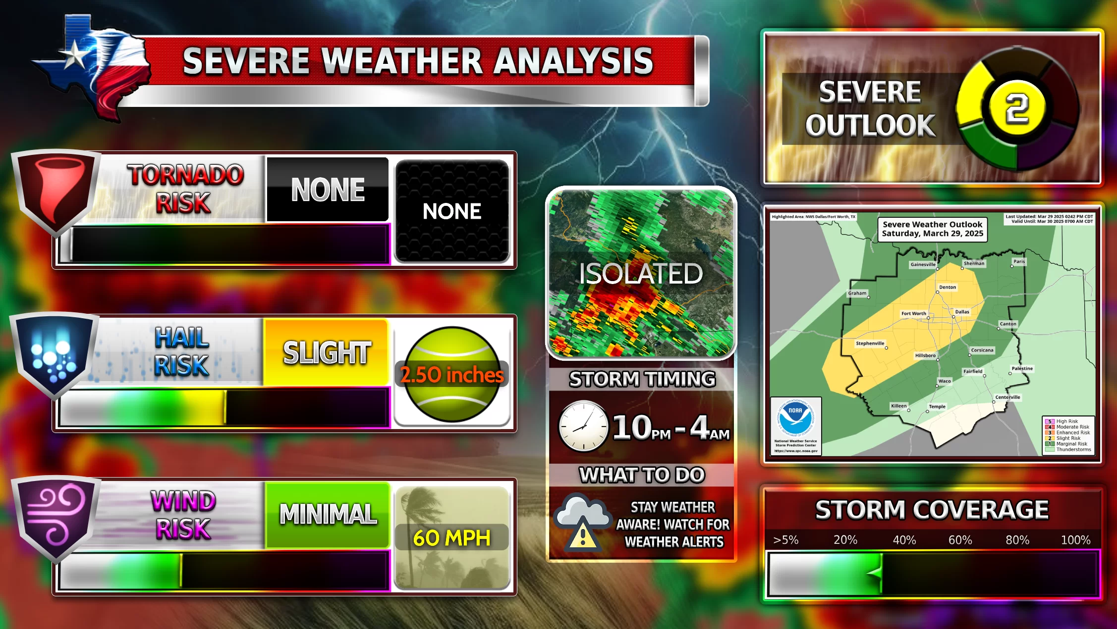
Isolated severe storms may develop ahead of a dryline late this evening, resulting in supercell development. Because of a strong cap in place, storm development is low at this time (15-25% chance Tuesday evening). Another line of storms is possible early Wednesday morning just before sunrise. Large hail and damaging winds may be associated with this line of storms if they form.
 TIMEFRAME
Tuesday evening, Tuesday overnight, and Wednesday morning
 WEATHER HAZARDS FOR TUESDAY
– ![]() Damaging wind gusts up to 60 MPH possible
Damaging wind gusts up to 60 MPH possible
– ![]() Isolated large hail up to 1.50 inches possible
Isolated large hail up to 1.50 inches possible
– ![]() A couple of spin-up tornadoes possible
A couple of spin-up tornadoes possible
WEDNESDAY
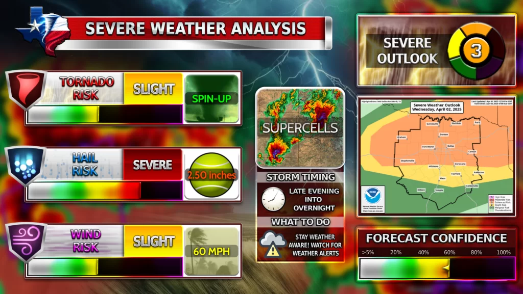
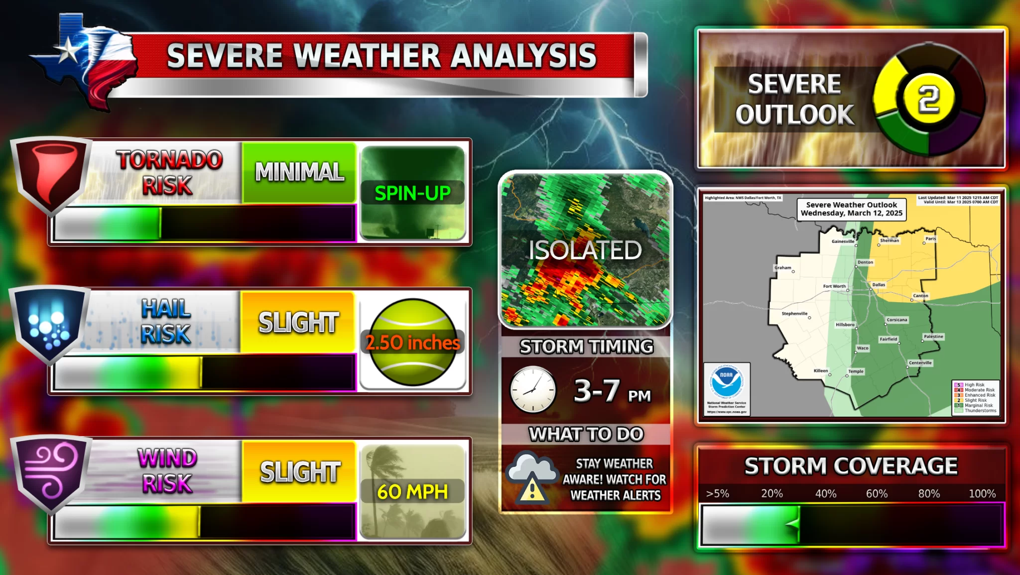
On Wednesday, we could see 2 rounds of storms. We could see some isolated storms capable of producing large hail and damaging winds coming up from the south into North Texas around the afternoon/evening hours. After midnight, several supercells are expected to develop, capable of all weather hazards, including tornadoes. Storm coverage will be highest north of I-20. Large hail, surpassing 2 inches in diameter, is also possible in some of these supercells.
TIMEFRAME
Wednesday evening and overnight
WEATHER HAZARDS FOR TUESDAY
– ![]() Damaging wind gusts up to 60 MPH possible
Damaging wind gusts up to 60 MPH possible
– ![]() Widespread large hail up to 2.00+ inches likely
Widespread large hail up to 2.00+ inches likely
– ![]() A couple of spin-up tornadoes possible
A couple of spin-up tornadoes possible
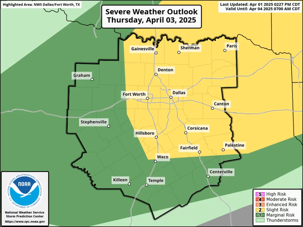
THURSDAY
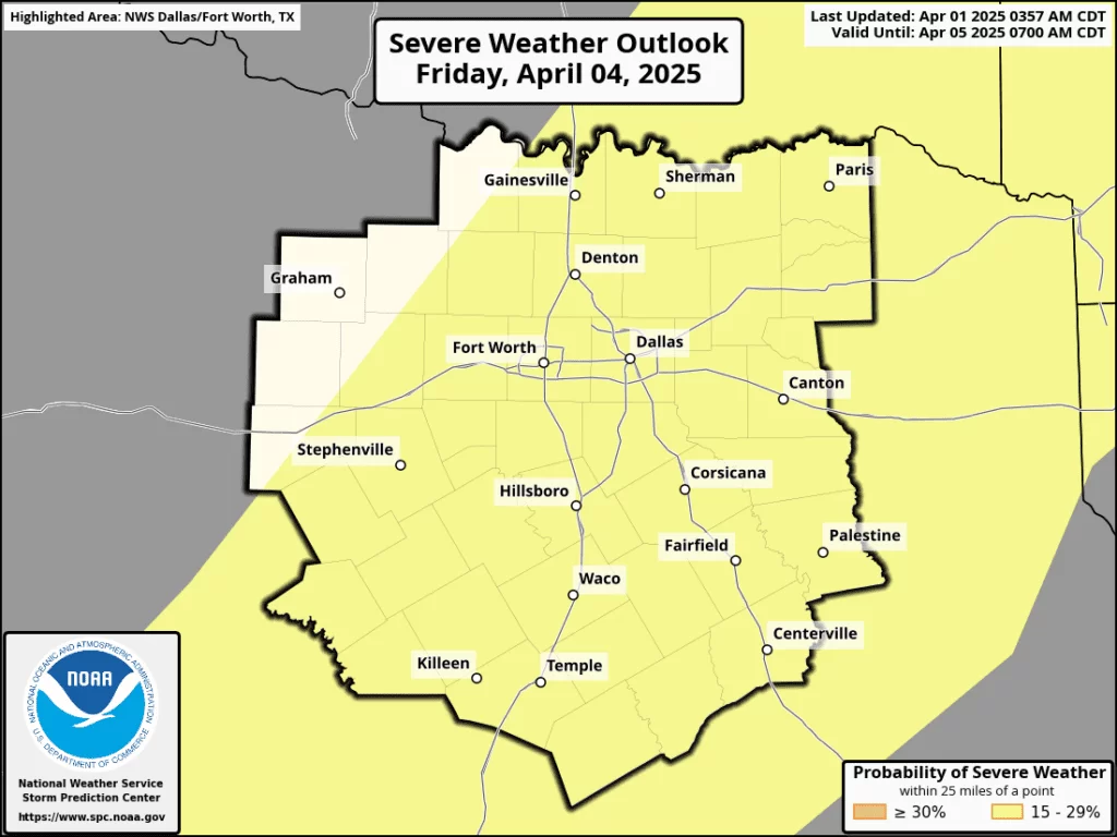
FRIDAY
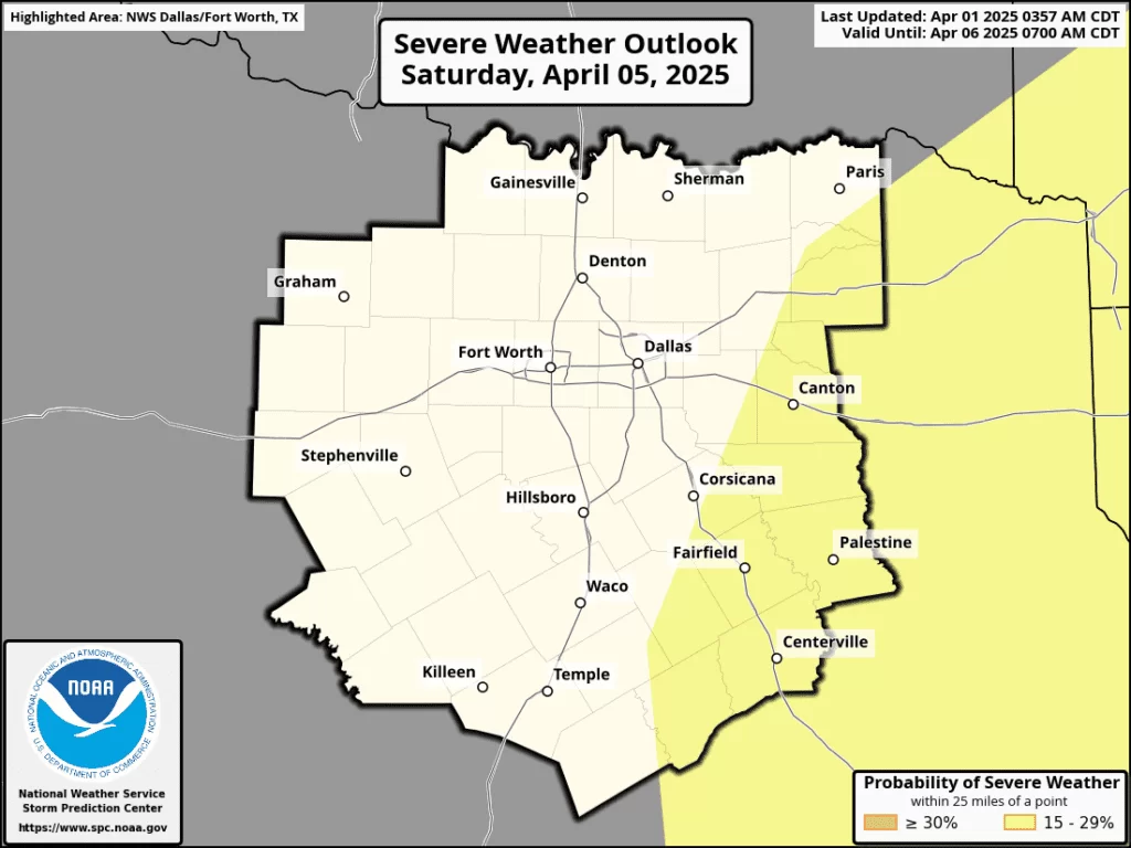
SATURDAY
Stay weather aware!
Become a TWC Member today for FREE!
Support Texas Weather Center
Join the TWC Membership through Patreon to show your support and keep TWC high quality and FREE!
Texas Weather Center Supporters
🥉Kathryn
🥇David Bass
🥉cslewis1234
🥉Robert Fasulo
🥈Carol