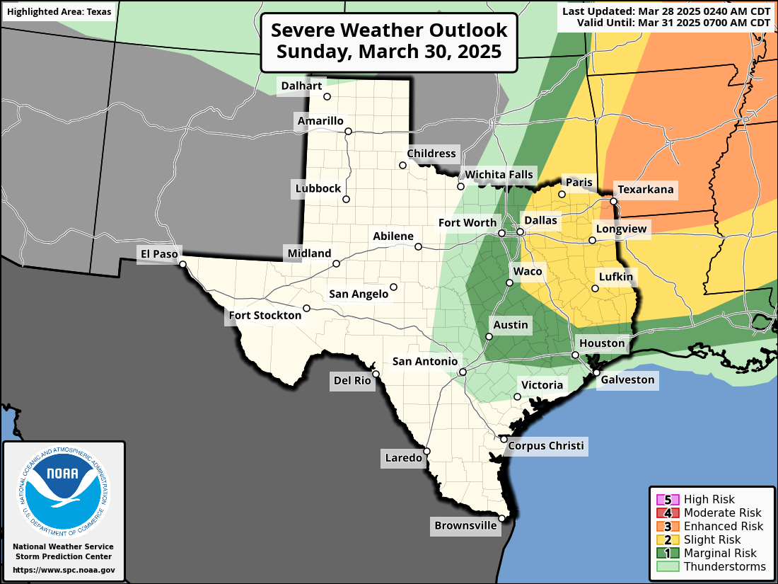
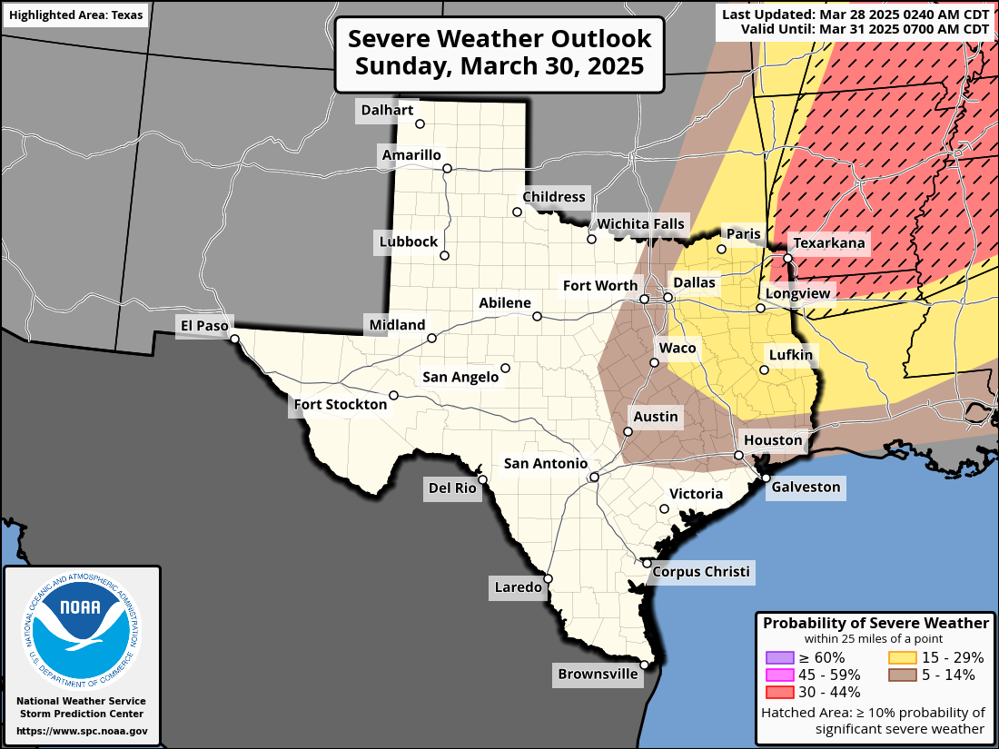
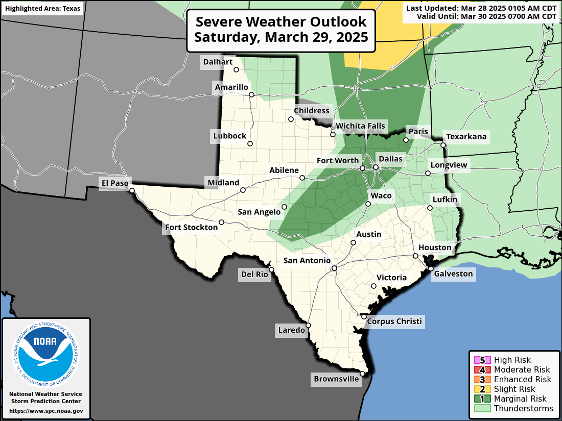
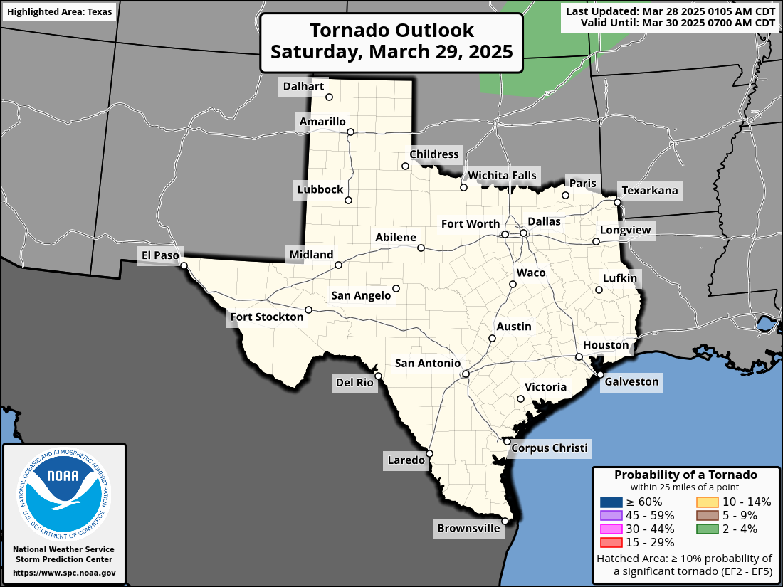
| Convective Outlooks
Know severe weather chances for the days ahead in North Texas
Understanding SPC Outlooks
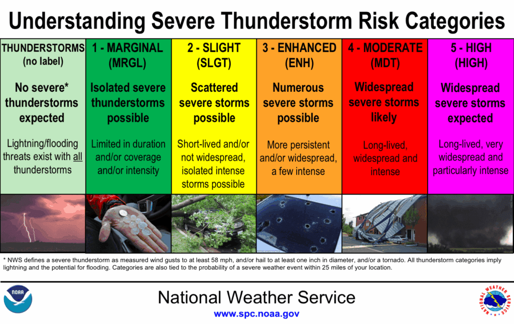
🟢 Thunderstorms
- Non-severe storms expected.
- Still includes lightning, heavy rain, and gusty winds.
Main Threats:
- ⚡ Frequent lightning
- 🌧️ Localized heavy rain
- 💨 Gusty winds
🟢 Marginal Risk
- Isolated severe storms possible.
- Short-lived or not widespread.
Main Threats:
- ☄️ Small hail
- 💨 Brief damaging winds
- 🌪 Low tornado risk
🟡 Slight Risk
- Scattered severe storms.
- A few may be intense.
Main Threats:
- ☄️ Large hail
- 💨 Damaging winds
- 🌪 Isolated tornadoes
🟠 Enhanced Risk
- Numerous severe storms expected.
- More persistent and organized.
Main Threats:
- ☄️ Very large hail
- 💨 Widespread damaging winds
- 🌪 A few strong tornadoes
🔴 Moderate Risk
- Widespread severe storms likely.
- Long-lived and intense.
Main Threats:
- 🌪 Strong, long-track tornadoes
- 💨 Widespread wind damage
- ☄️ Destructive hail
🟣 High Risk
- Severe weather outbreak expected.
- Most dangerous setup.
Main Threats:
- 🌪 Violent, long-track tornadoes
- 💨 Destructive straight-line winds
- ☄️ Giant hail
-

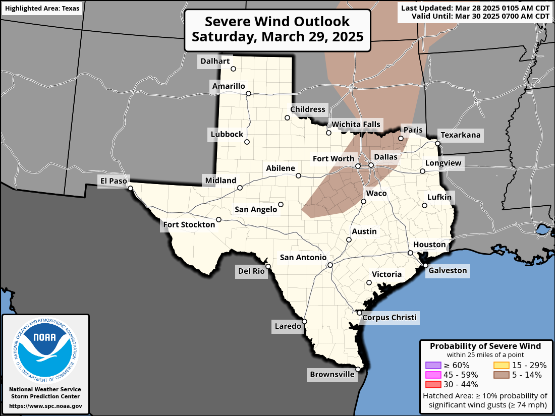
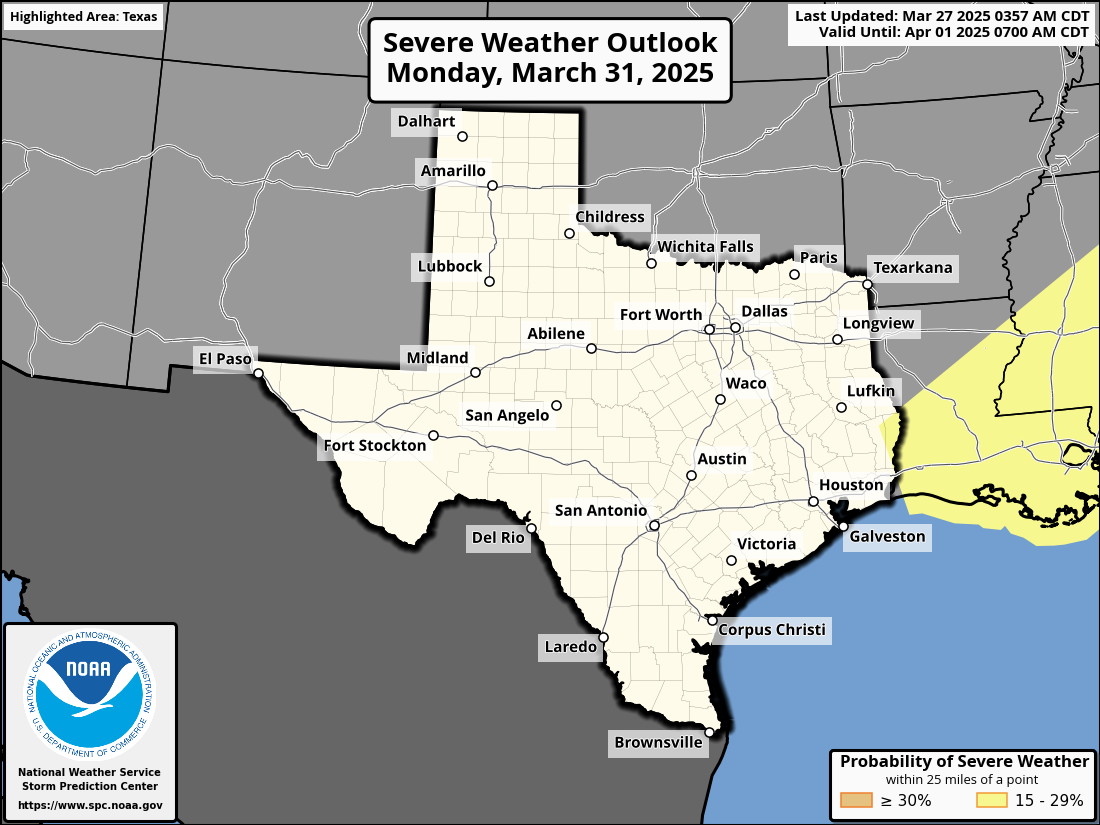
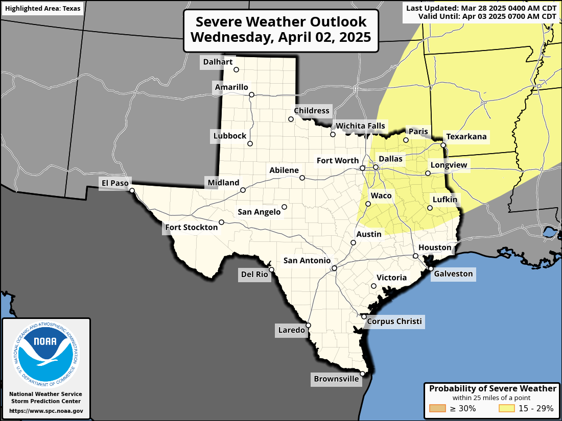
Day 1
-

Tornado Risk
-

Wind Risk
-

Hail Risk
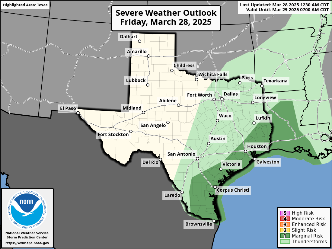
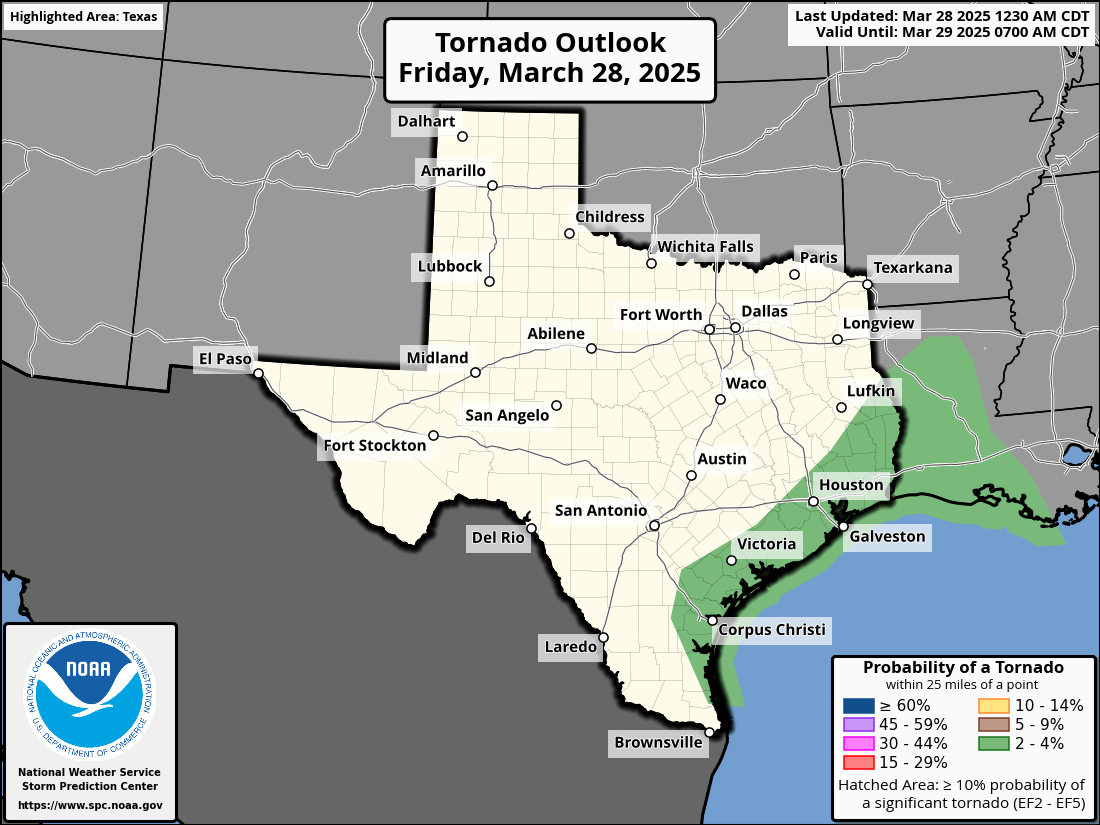
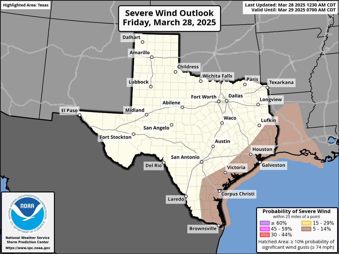

-
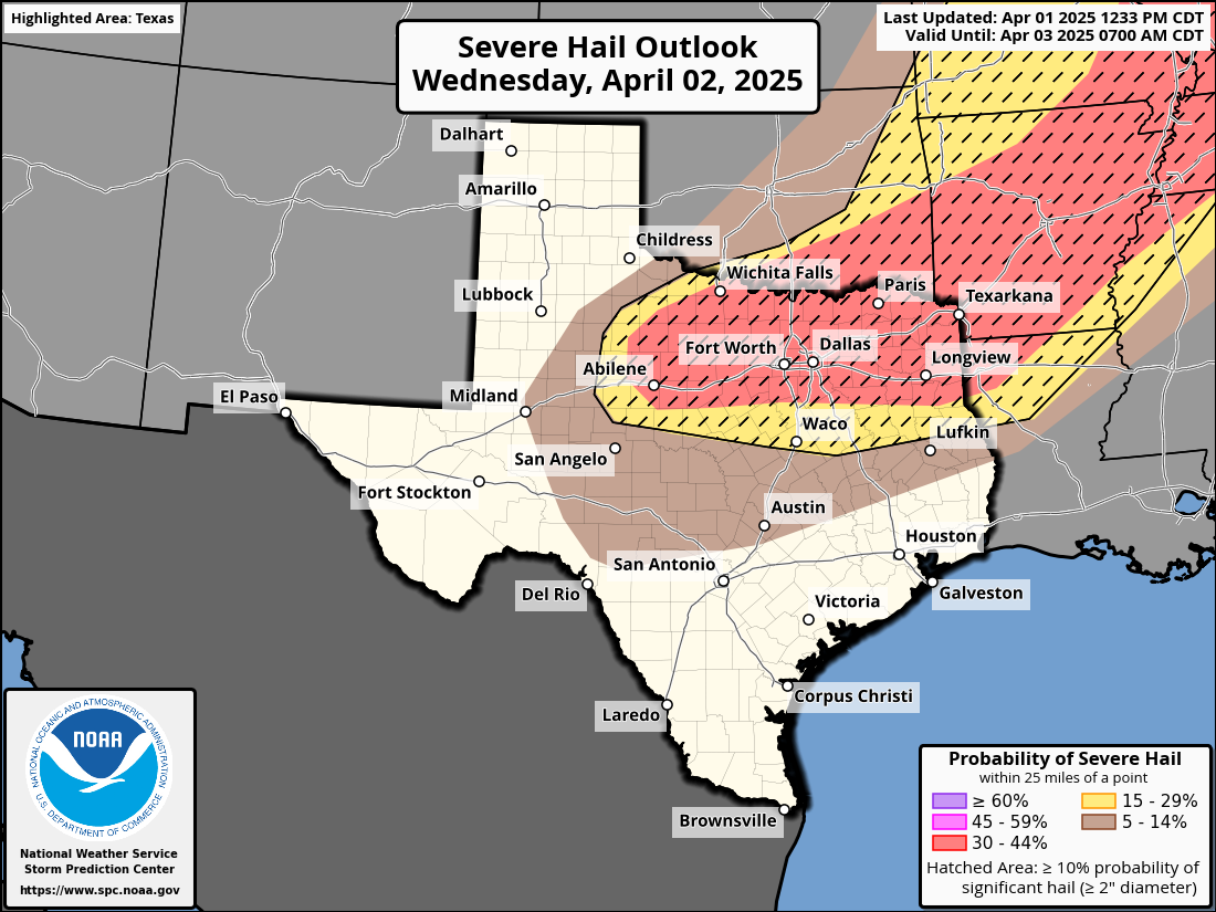
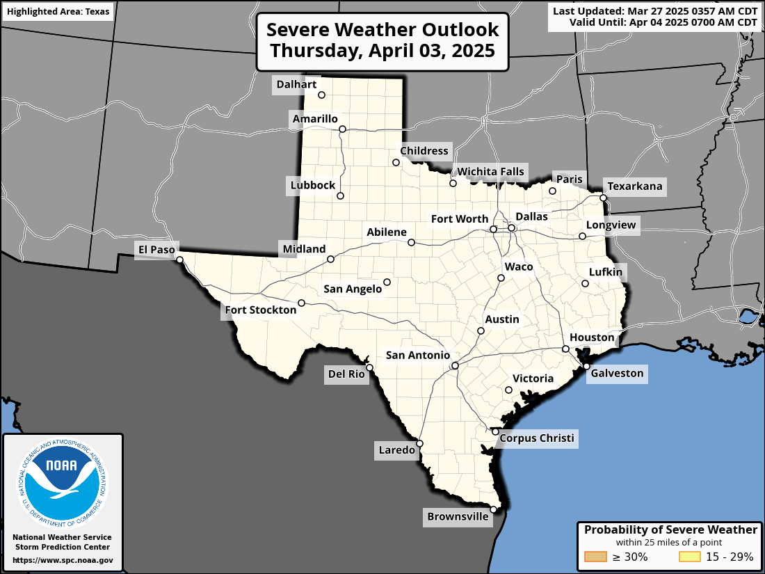
Day 3
-

Probability
-
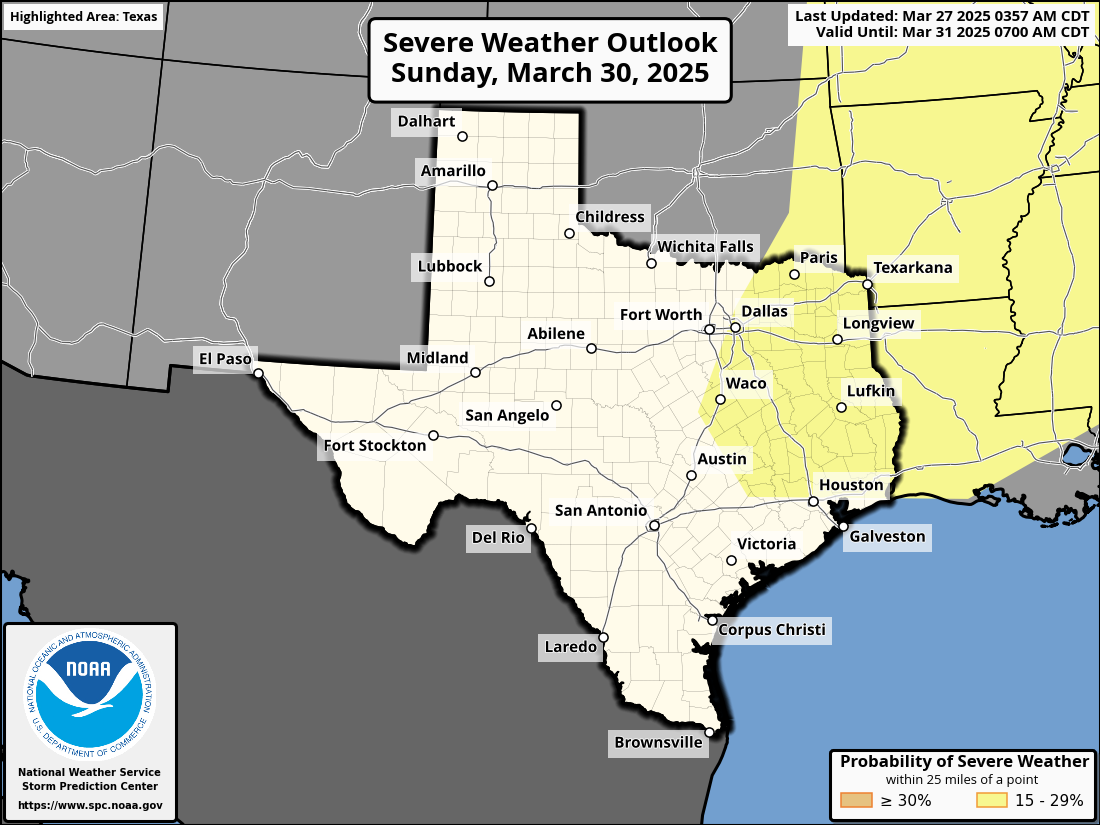
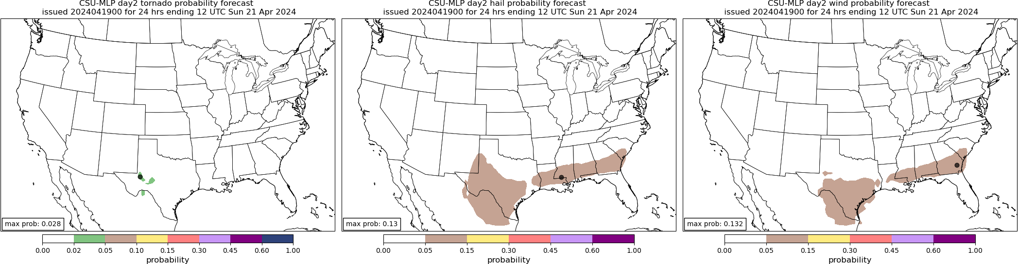
Day 2
-
Tornado Risk
-
Wind Risk
-
Hail Risk
-
Day 4
-
Day 5
-
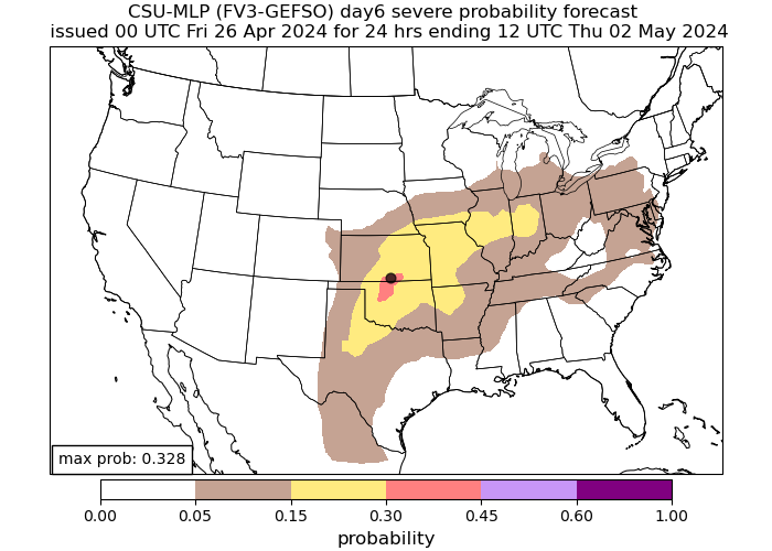
Day 6
-
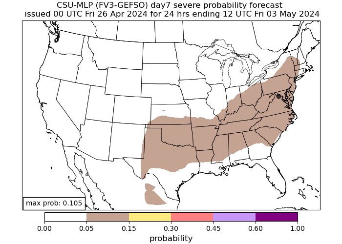
Day 7
-
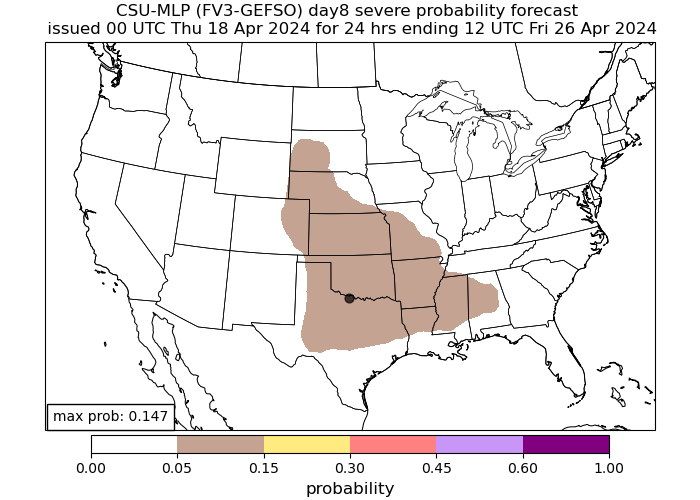
Day 8

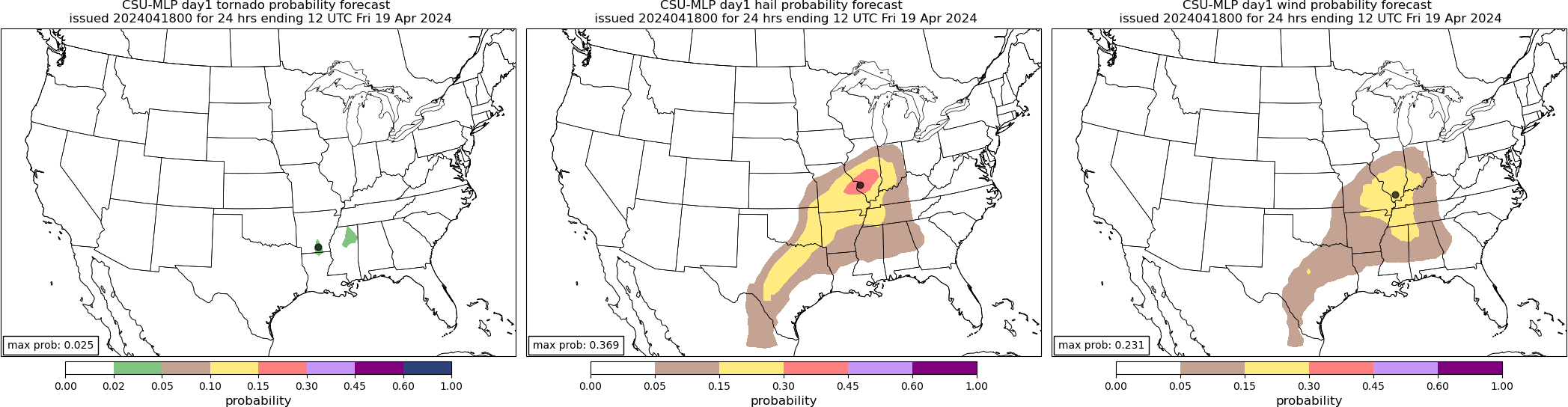
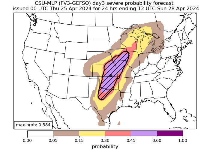
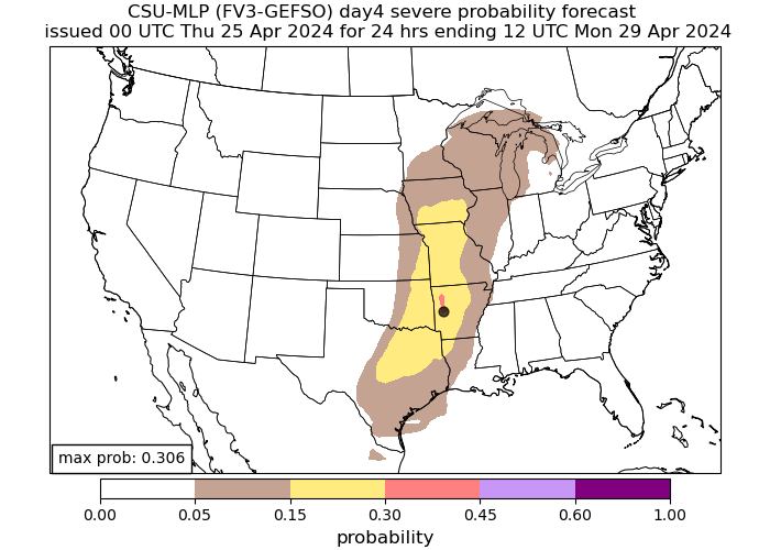
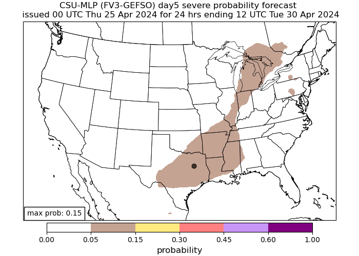
CSU Machine-Learning Severe Outlook
Understanding the CSU Weather Model
The CSU (Colorado State University) machine-learning weather model refers to a suite of numerical weather prediction models developed and maintained by the Department of Atmospheric Science at Colorado State University. These models are used for both research and operational weather forecasting. The research CSU specializes in involves the prediction of extreme weather hazards via statistical postprocessing techniques. These models forecast farther out than SPC models can in most cases, giving a good idea to the general public about what severe weather events may come in the near future.
-
Day 1
-
Day 2
-
Day 3
-
Day 4
-
Day 5
-
Day 6
-
Day 7
-
Day 8


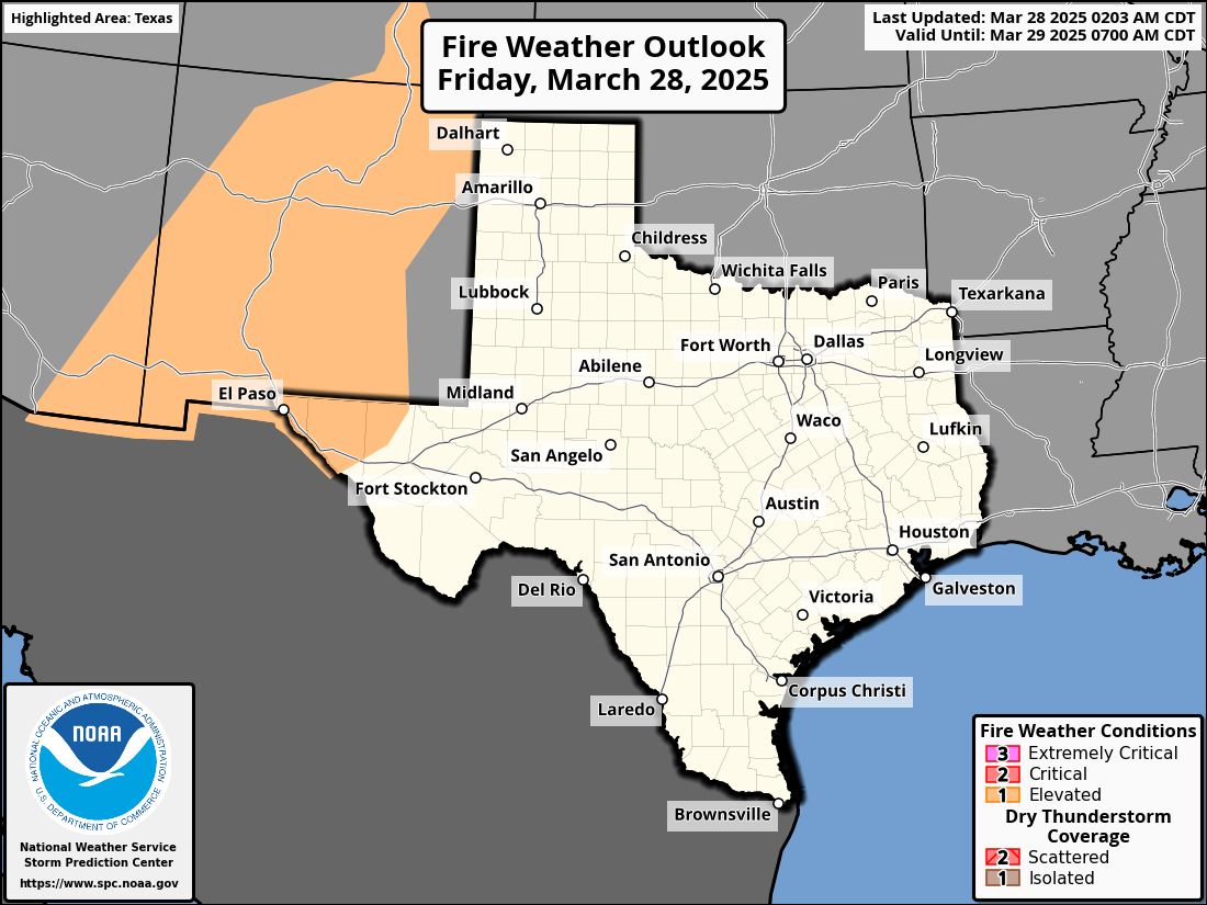
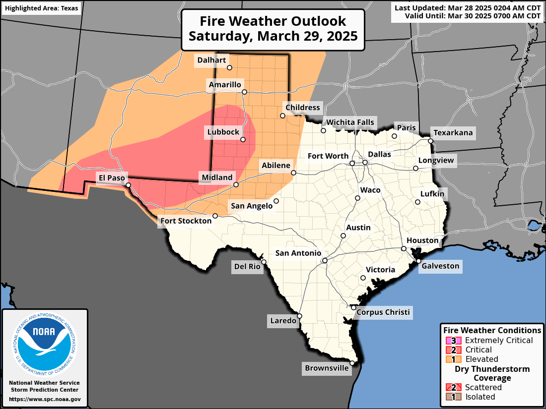
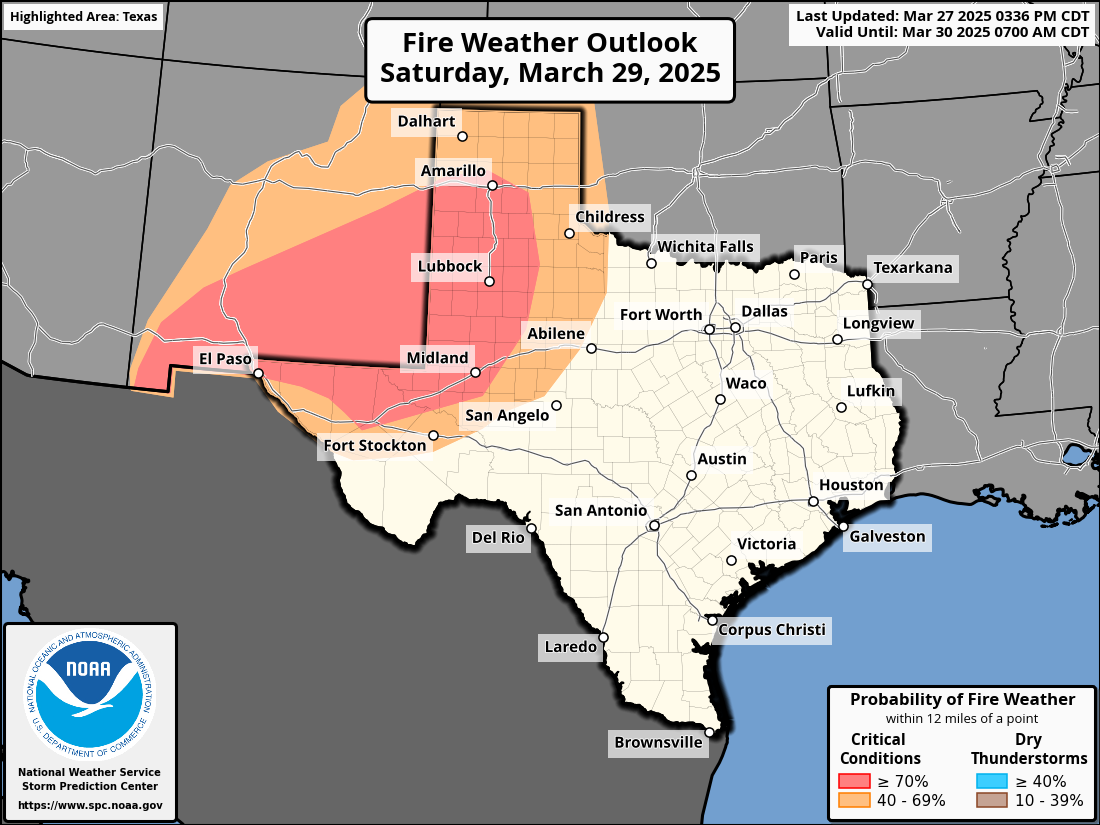
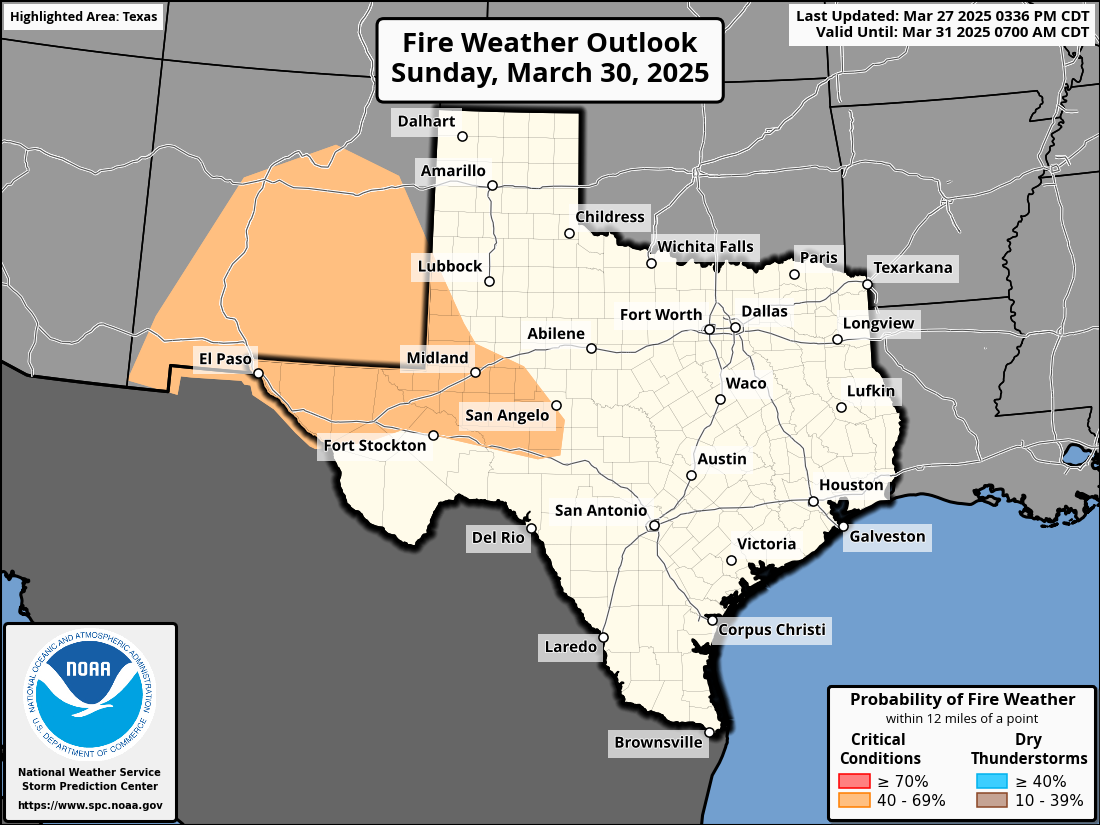
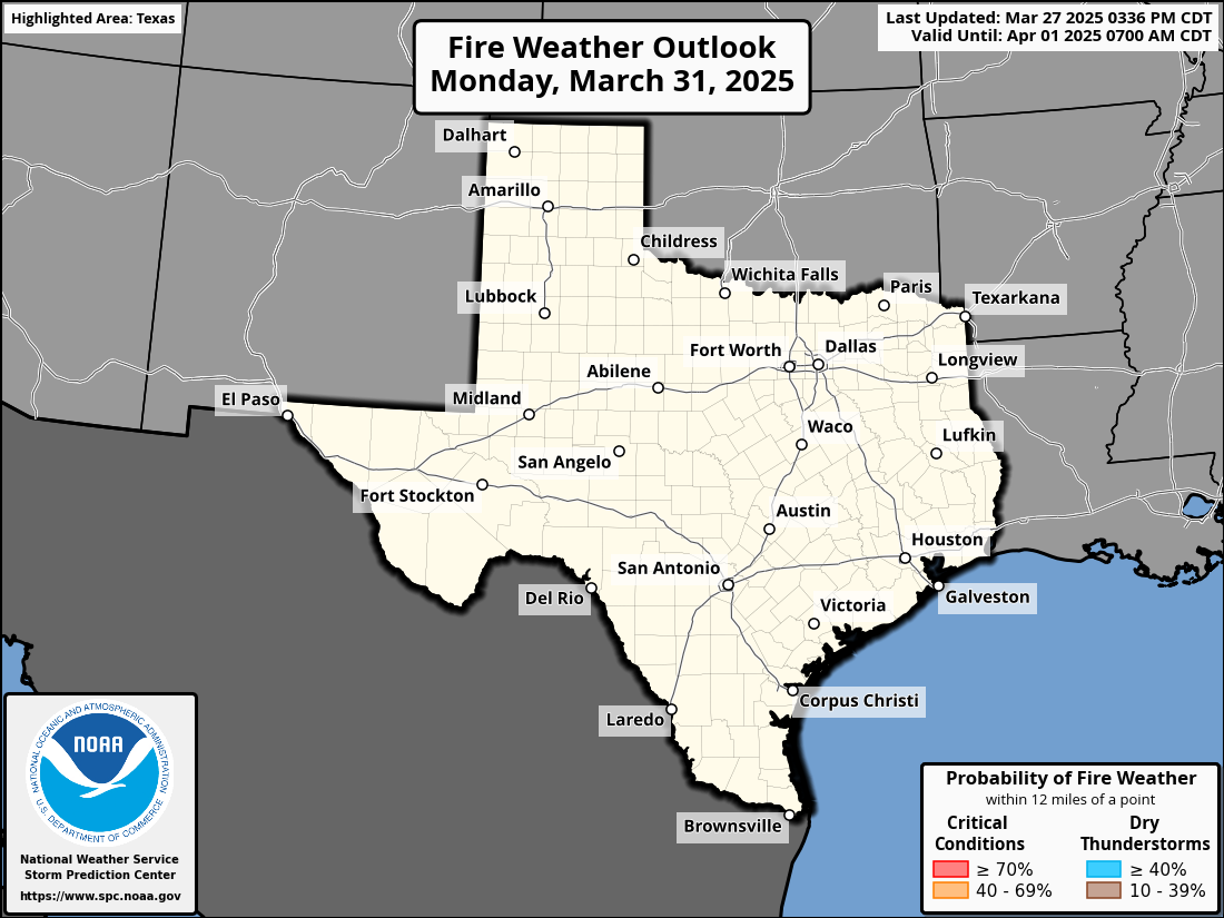
Fire Weather Outlook
-
Day 1
-
Day 2
-
Day 3
-
Day 4
-
Day 5
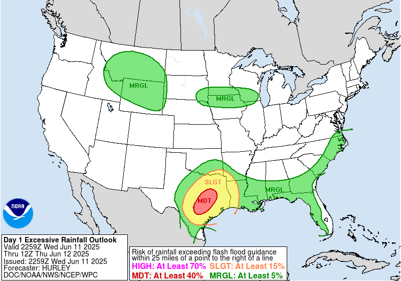
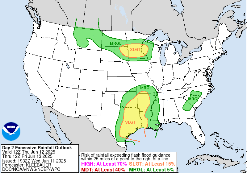
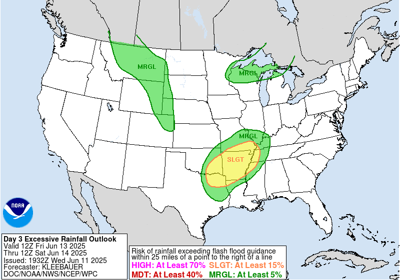
Flash Flood Outlook
-
Day 1
-
Day 2
-
Day 3