| Hurricane Tracking
See the latest Hurricane Outlooks, track hurricanes with an interactive map, and see the latest satellite imagery of the hurricanes!
 Active Storm Erin
-
Key Messages
-
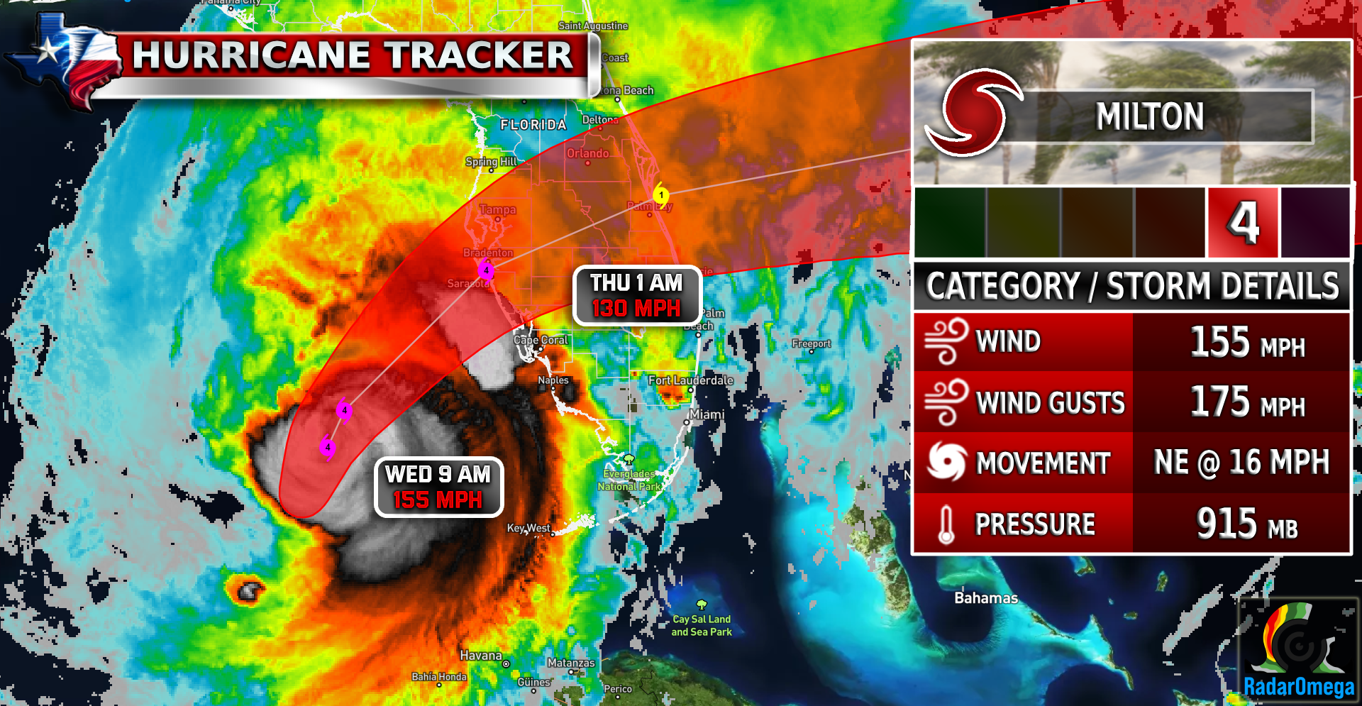
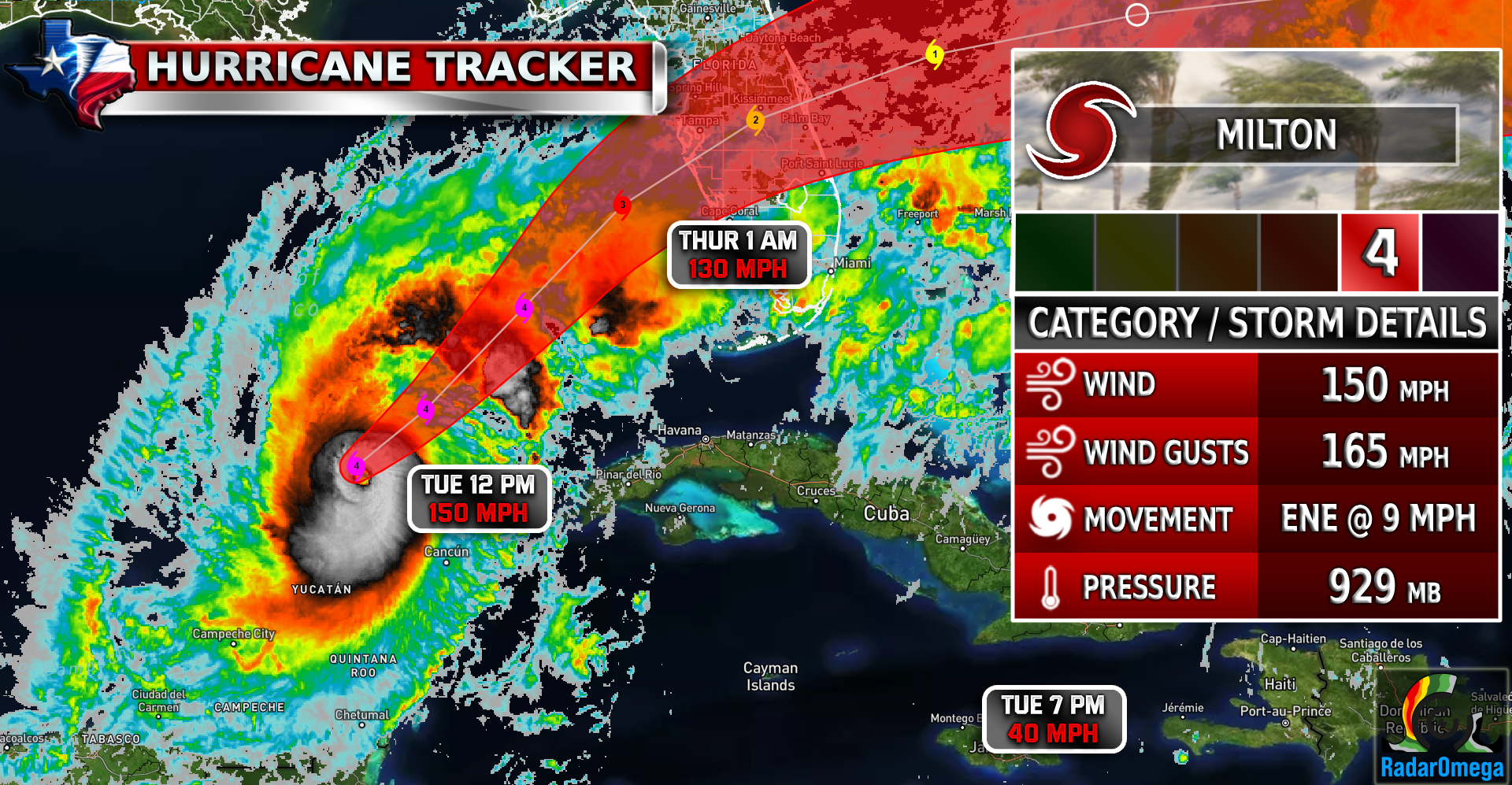
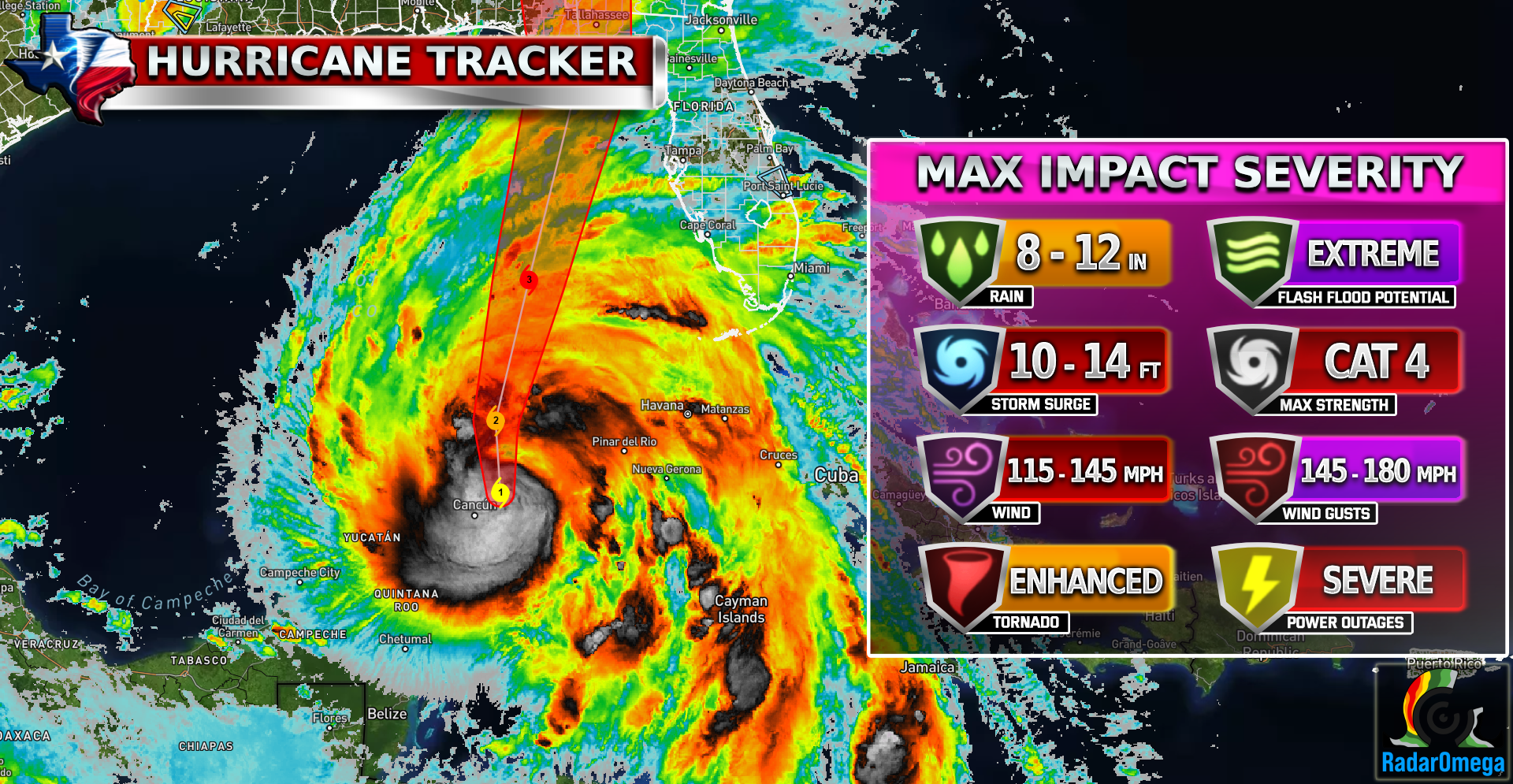
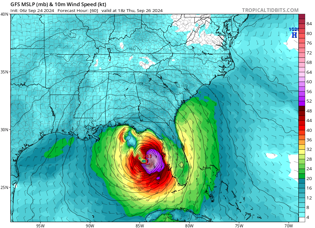
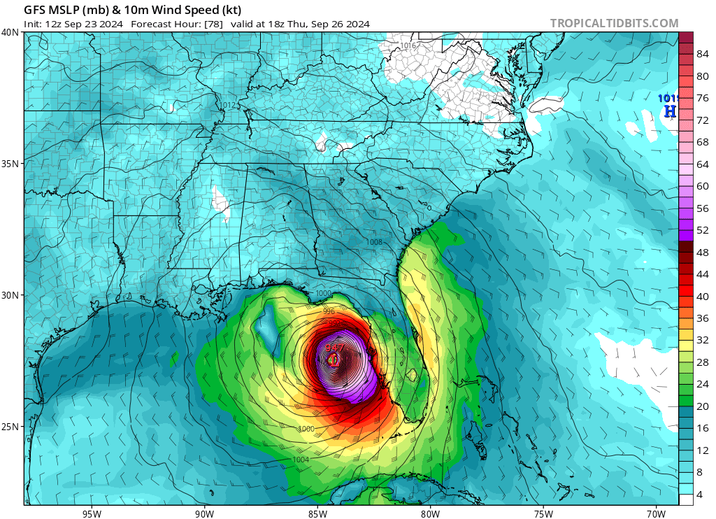
Tracking
-
Flooding Outlook
-
Rainfall Outlook
-
Sub-Severe Winds
-
TS Force Winds
-
Hurricane Force Winds
-
Tornado Risk
-
Storm Surge


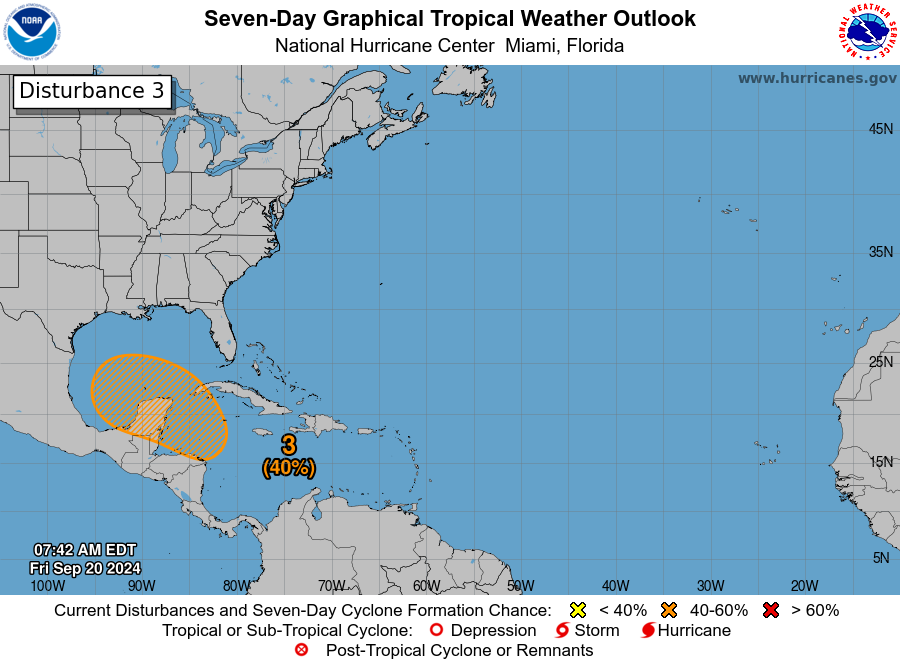
7-Day Tropical Weather Outlooks
-
Atlantic Ocean
-
Eastern Pacific Ocean
-
Central Pacific Ocean


| Satellite Imagery
See the latest Satellite Imagery of the southern plains, the US, and the whole disk! See various types of imagery like infrared, water vapor, visible, and more!
Interactive Weather Map
Latest Hurricane Blogs
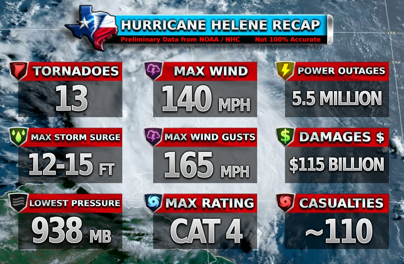

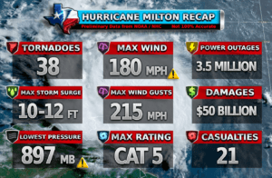
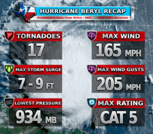
| Historical Hurricane Recaps
See all of the Texas Weather Center Hurricane recap graphics for each hurricane!