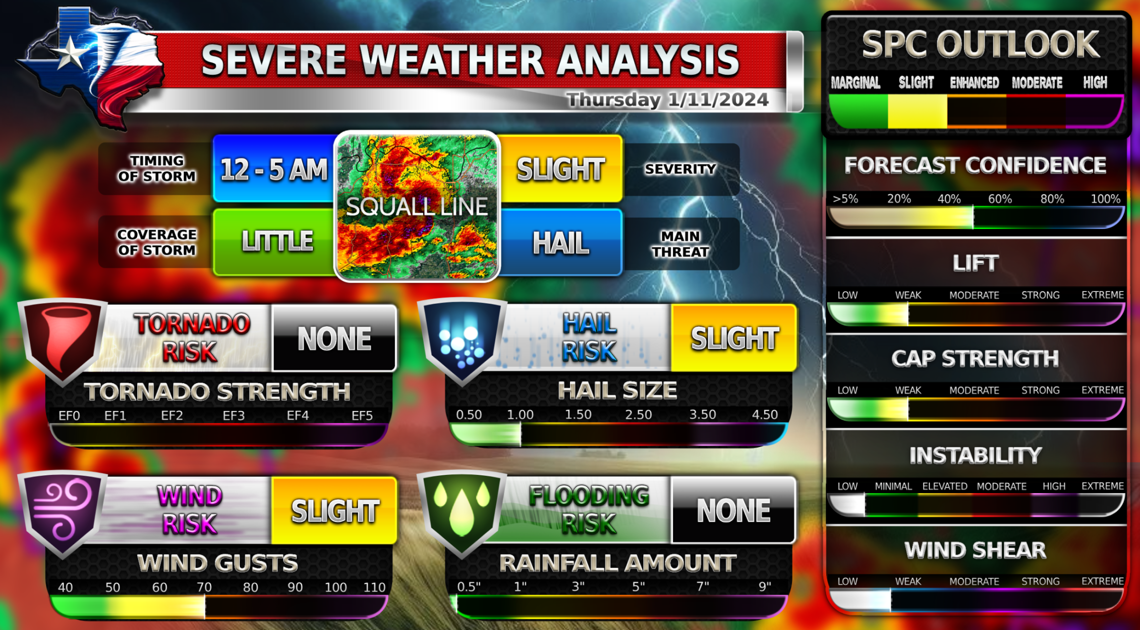
Severe Weather is possible late tonight Thursday and overnight into Friday for parts of DFW. Some of DFW is under a slight risk because of a chance of large hail and damaging winds, but the main threat remains in the Ark-La-Tex area up northeast of DFW. There is a rising tornado risk as well in the Ark-La-Tex area with some strong tornadoes possible, but the DFW area remains at a very low tornado risk.
The most likely scenario for tonight’s severe weather chance is that the line of storms will develop east of the DFW metroplex and only parts of DFW will get rain. The other more unlikely scenario is a severe weather setup described in the weather model above. Storms will all arrive past midnight and will be out of the metroplex by daybreak on Friday. Stay weather aware.
2️⃣Slight Risk
![]() Low chance of tornadoes
Low chance of tornadoes![]() Large hail up to 1.5 Inches possible
Large hail up to 1.5 Inches possible![]() Damaging winds up to 60 MPH
Damaging winds up to 60 MPH
Stay tuned for a blog soon about the Winter Weather setup on Sunday and Monday! Winter precipitation is still uncertain for DFW. Stay tuned to the upcoming blog for more details.
Become a TWC Member today for FREE!
Support Texas Weather Center
Join the TWC Membership through Patreon to show your support and keep TWC high quality and FREE!
Texas Weather Center Supporters
🥉Kathryn
🥇David Bass
🥉cslewis1234
🥉Robert Fasulo
🥈Carol