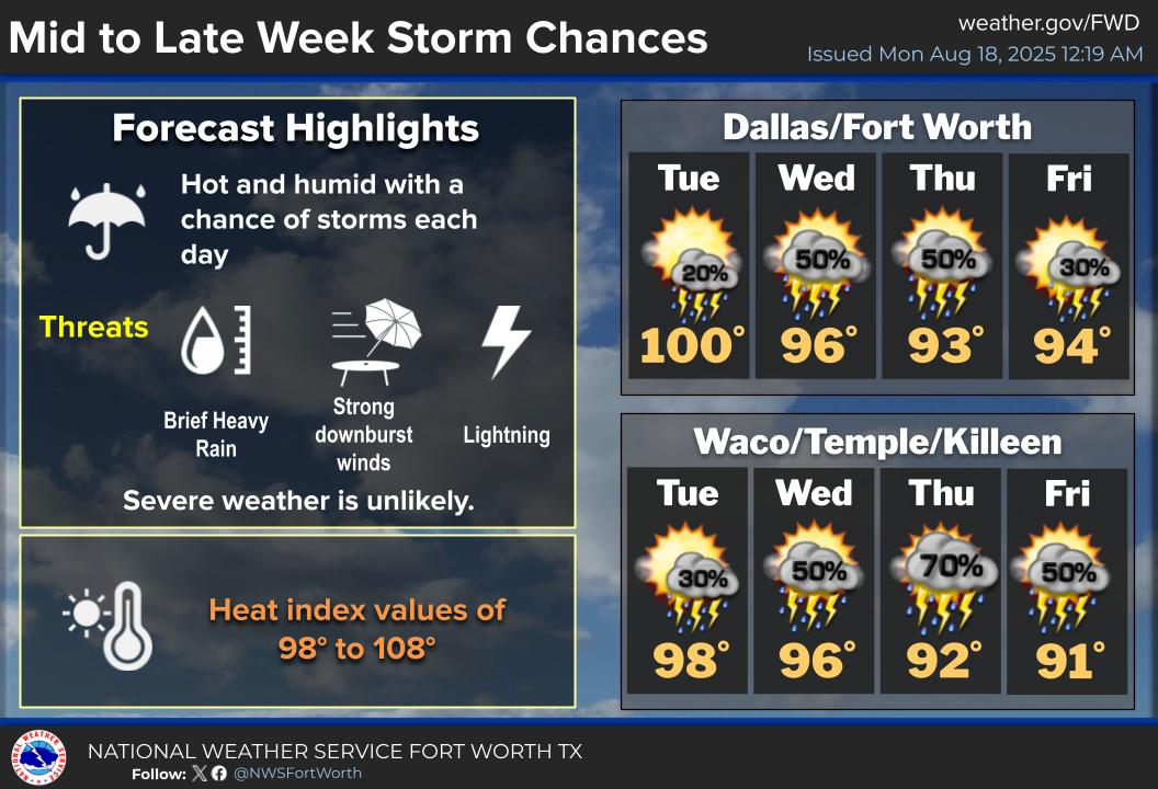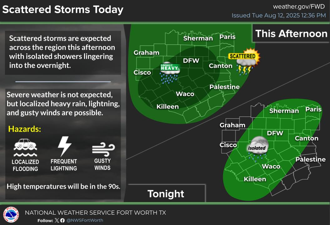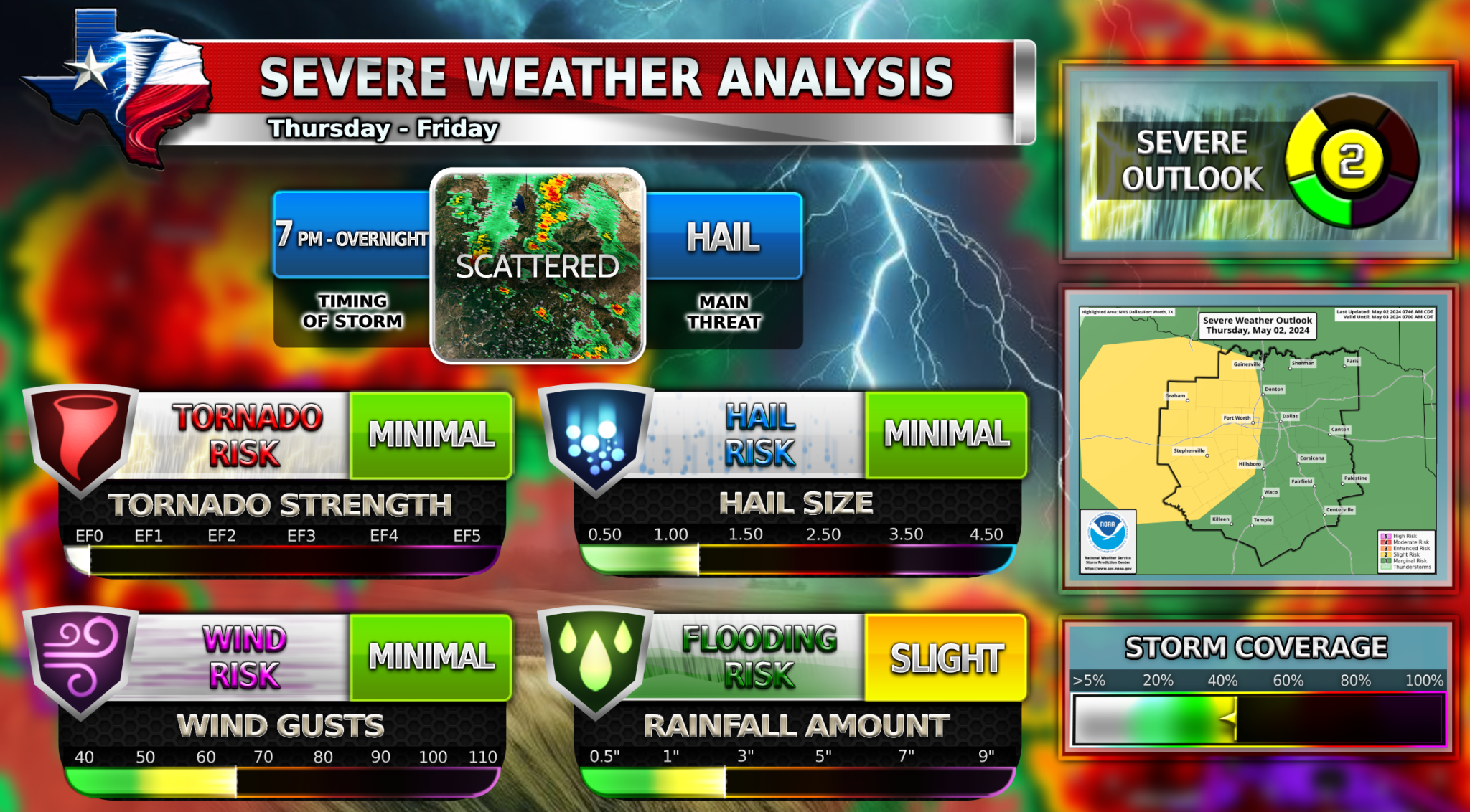
Numerous thunderstorms will continue this morning across Central and East Texas. The flood threat will remain elevated through the morning! Additional storms are expected to develop across western North Texas this afternoon. These storms will have the highest threat of severe weather just west of DFW but as the evening progresses they are expected to move East into the metroplex. These storms will turn into a broken line of storms that will move through DFW in late evening/midnight hours. If storms are severe, they could contain large hail and damaging winds. Not everyone will see storms, and the majority of everyone won’t see any severe weather. Stay weather aware.
2️⃣Slight Risk
![]() Low chance of tornadoes
Low chance of tornadoes![]() Large hail up to 1.5 Inches possible
Large hail up to 1.5 Inches possible![]() Damaging winds up to 60 MPH
Damaging winds up to 60 MPH
Become a TWC Member today for FREE!
Support Texas Weather Center
Join the TWC Membership through Patreon to show your support and keep TWC high quality and FREE!
Texas Weather Center Supporters
🥉Kathryn
🥇David Bass
🥉cslewis1234
🥉Robert Fasulo
🥈Carol